alb3836336
Mauna Loa Volcano
| Share |
|---|
 Pinterest Pinterest |
 Twitter Twitter |
 Facebook Facebook |
 Copy link Copy link |
 Email Email |
|
Add to another lightbox |
|
Add to another lightbox |


Buy this image.
Select the use:

Title:
Mauna Loa Volcano
Caption:
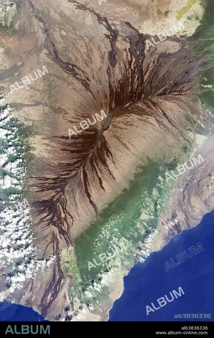
Mauna Loa, as seen by the Operational Land Imager (OLI) on the Landsat 8 satellite, February 9, 2016. Moku'aweoweo Crater is in the center. Dried lava flows surround the two main rift zones. Mauna Loa is the largest volcano on Earth.
Credit:
Album / Science Source / NASA Earth Observatory/Jesse Allen
Releases:
Model: No - Property: No
Rights questions?
Rights questions?
Image size:
4000 x 6000 px | 68.7 MB
Print size:
33.9 x 50.8 cm | 13.3 x 20.0 in (300 dpi)
Keywords:
2016 • AERIAL PHOTO • AERIAL SHOT • AERIAL VIEW • AERIAL • AMERICAN • BIG ISLAND • CALDERA • COOLED • CRATER (GEOLOGY) • CRATER • CRATER, VOLCANO • DRIED LAVA • EARTH FROM SPACE • EARTH SCIENCE • FLOW PATTERNS • GEOGRAFIA • GEOGRAPHIC • GEOGRAPHY • GEOLOGIA • GEOLOGIC FORMATION • GEOLOGICAL • GEOLOGY • HAWAI'I • HAWAII • HAWAIIAN ISLANDS • IMAGERY • LANDFORM • LANDSAT 8 • LANDSAT PHOTO • LANDSAT • LANDSCAPE • LANDSCAPES • LAVA FLOW • MAUNA LOA • MOKU'AWEOWEO CRATER • MOKUAWEOWEO • MOUNTAIN • NATURAL COLOR • OBSERVATION • OLD ERUPTIONS • OLI • OPERATIONAL LAND IMAGER • PACIFIC AMERICA • PEAK • RIFT ZONE • SATELLITE IMAGE • SATELLITE PHOTOGRAPHY • SHIELD VOLCANO • SUMMIT • UNITED STATES • US • USA • VOLCANIC • VOLCANO • VOLCANOES NATIONAL PARK • VOLCANOLOGY • VULCAN • VULCANO
