alb4070953
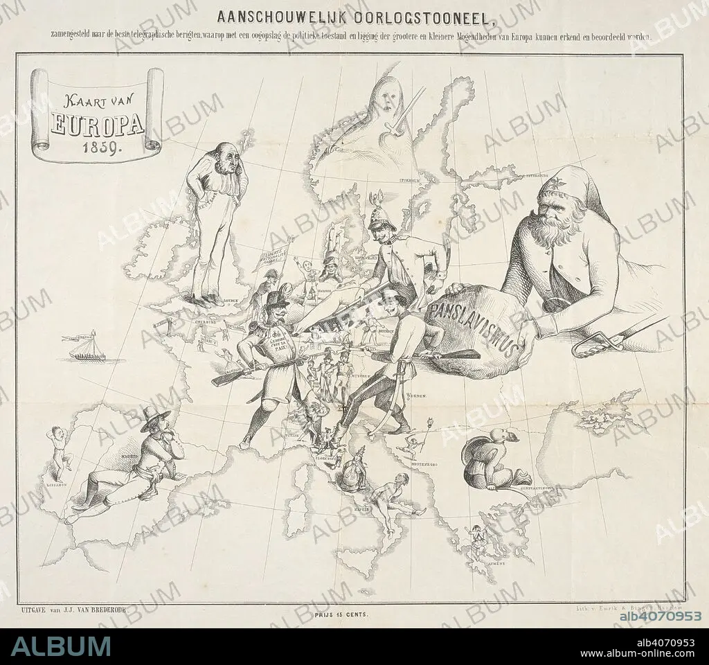
A Dutch cartoon map illustrating the political situation of Europe during the Franco-Austrian War. Kaart van Europa 1859. Haarlem : Emrik & Binger, 1859. Source: Maps CC.5.a.476. Language: Dutch.
| Share |
|---|
 Pinterest Pinterest |
 Twitter Twitter |
 Facebook Facebook |
 Copy link Copy link |
 Email Email |
|
Add to another lightbox |
|
Add to another lightbox |


Caption:
A Dutch cartoon map illustrating the political situation of Europe during the Franco-Austrian War. Kaart van Europa 1859. Haarlem : Emrik & Binger, 1859. Source: Maps CC.5.a.476. Language: Dutch.
Credit:
Album / British Library
Releases:
Model: No - Property: No
Rights questions?
Rights questions?
Image size:
5017 x 4446 px | 63.8 MB
Print size:
42.5 x 37.6 cm | 16.7 x 14.8 in (300 dpi)
Keywords:
19TH CENTURY • 19TH • ARMED CONFLICT • ARMED CONFLICTS • ARMY: SOLDIER • CARICATURE • CARICATURES • CARTE • CARTOGRAPHIC • CARTOGRAPHY • CARTOON • COMBAT • CURIOSITY • CURIOUS • EUROPA • EUROPE • GROUP OF PEOPLE • HUNDRED YEARS WAR • MAP MAKING • MAP • MAPS • MILITARY EVENT • MILITARY EVENTS • MILITARY OCCUPATIONS • NOSINESS • NOSY • PEOPLE'S ARMY SOLDIER • PLAN (CARTOGRAPHY) • SOLDIER • SOLDIERS • SOLIDER • TROOPER • TROOPS • WAR • WARFARE • WARRIOR • WARRIORS
