alb3279201
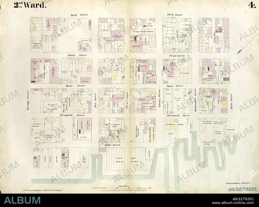
Plate 4: Map bounded by East River, Bridge Street, York Street, Main Street. 1855, William Perris, Brooklyn, New York, N.Y., USA.
| Share |
|---|
 Pinterest Pinterest |
 Twitter Twitter |
 Facebook Facebook |
 Copy link Copy link |
 Email Email |
|
Add to another lightbox |
|
Add to another lightbox |


Buy this image.
Select the use:

Caption:
Plate 4: Map bounded by East River, Bridge Street, York Street, Main Street. 1855, William Perris, Brooklyn, New York, N.Y., USA
Credit:
Album / quintlox
Releases:
Model: No - Property: No
Rights questions?
Rights questions?
Image size:
6039 x 4522 px | 78.1 MB
Print size:
51.1 x 38.3 cm | 20.1 x 15.1 in (300 dpi)
Keywords:
AMERICA • AMERICA. • AMERICAS • AMERICAS, THE • BRIDGE STREET • BROOKLYN • CARTOGRAPHIC • CARTOGRAPHY • EAST RIVER • EEUU • GEOGRAFIA • GEOGRAPHY • HISTORIC MAP • MAIN STREET 1855 • MANHATTAN, NEW YORK • MAP BOUNDED BY • MAP MAKING • MAP • MAPS • NEW YORK CITY • NEW YORK • NEW YORK, USA • NY • OLD MAP • PLAN (CARTOGRAPHY) • PLATE 4 • U. S. A • U. S. A. • UNITED STATES • USA • VINTAGE MAP • WILLIAM PERRIS • YORK STREET
