alb8361539
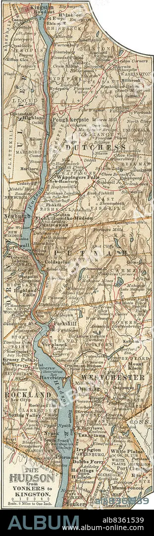
Map of the Hudson River, New York
| Share |
|---|
 Pinterest Pinterest |
 Twitter Twitter |
 Facebook Facebook |
 Copy link Copy link |
 Email Email |
|
Add to another lightbox |
|
Add to another lightbox |


Buy this image.
Select the use:

Caption:
Map of the Hudson River, New York
Credit:
Album / Universal Images Group / Encyclopaedia Britannica
Releases:
Image size:
2884 x 9481 px | 78.2 MB
Print size:
24.4 x 80.3 cm | 9.6 x 31.6 in (300 dpi)
Keywords:
10TH EDITION • 19 CENTURY • 1900 • 1900S • 1902 • 1990S • 19TH CENTURY • 19TH CENTURY. • 19TH • 19TH-CENTURY • 90S • AMERICA NORTH • BOUNDARIES • BOUNDARY • CARTOGRAPHY • COLDSPRING • CORNWALL • DETAIL • DUTCHESS • EARLY 20TH CENTURY • EARLY TWENTIETH CENTURY • EEUU • EXPLORATION • FRONTIER • GEOGRAFIA • GEOGRAPHICAL • GEOGRAPHY • HIGHLAND FALLS • HISTORIA UNIVERSAL • HISTORIA • HISTORICAL • HISTORY • HISTORY. • HUDSON RIVER • INSET • KINGSTON • LIMIT • MAMA RONECK • MAMARONECK • MANHATTAN, NEW YORK • MAP MAKING • MAP • MAPS • MATTEAWAN • NEW YORK CITY • NEW YORK • NEW YORK, USA • NEWBURGH • NINETEENTH CENTURY • NINETIES • NINETIES, THE • NINETY DECADE • NORTH AMERICA • NORTH AMERICAN • PEEKSKILL • PHYSICAL MAP • PLAN (CARTOGRAPHY) • PORT EWEN • POUGH KEEPSIE • PUTNAM • RHINEBECK • RONDOUT • TENTH EDITION • U S A • U. S. A • U. S. A. • ULSTER • UNITED STATES AMERICA • UNITED STATES OF AMERICA • UNITED STATES • USA • USA. UNITED STATES • VERTICAL LINES • VERTICAL • WAPPINGERS FALLS • WHITE PLAINS • XIX CENTURY • YONKERS
