alb4068058
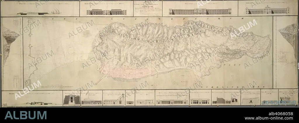
A plan of the isthmus, city and fortifications of Gibraltar. A colored "plan of the isthmus, city, and fortifications of Gibraltar, shewing elevations and sections of the principal public buildings, profiles through the two extremities of the rock, and forts built by the Spaniards; also the soundings and particular heights of the hill laid down on the plan, with several additional designs for better defending and securing the place;". 1751. Source: Maps K.Top.72.36. Language: English.
| Share |
|---|
 Pinterest Pinterest |
 Twitter Twitter |
 Facebook Facebook |
 Copy link Copy link |
 Email Email |
|
Add to another lightbox |
|
Add to another lightbox |


Caption:
A plan of the isthmus, city and fortifications of Gibraltar. A colored "plan of the isthmus, city, and fortifications of Gibraltar, shewing elevations and sections of the principal public buildings, profiles through the two extremities of the rock, and forts built by the Spaniards; also the soundings and particular heights of the hill laid down on the plan, with several additional designs for better defending and securing the place;". 1751. Source: Maps K.Top.72.36. Language: English.
Personalities:
Credit:
Album / British Library
Releases:
Model: No - Property: No
Rights questions?
Rights questions?
Image size:
10500 x 3798 px | 114.1 MB
Print size:
88.9 x 32.2 cm | 35.0 x 12.7 in (300 dpi)
Keywords:
18TH CENTURY • 18TH CENTURY, THE • 18TH • ARCHIVE • ARCHIVES • DOCUMENT • GIBRALTAR • GIBRALTER • NO ONE • NO-ONE • NOBODY • PLAN • XVIII CENTURY
