alb5364408
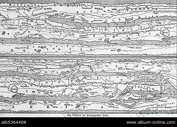
A section from the cartographic representation of the Peutinger's Table (Tabula Peutingeriana), UNESCO World Document Heritage, historical world map, illustration from 1881.
| Share |
|---|
 Pinterest Pinterest |
 Twitter Twitter |
 Facebook Facebook |
 Copy link Copy link |
 Email Email |
|
Add to another lightbox |
|
Add to another lightbox |


Buy this image.
Select the use:

Caption:
A section from the cartographic representation of the Peutinger's Table (Tabula Peutingeriana), UNESCO World Document Heritage, historical world map, illustration from 1881
Credit:
Album / ImageBroker / Wolfgang Diederich
Releases:
Model: No - Property: No
Rights questions?
Rights questions?
Image size:
600 x 398 px | 699.6 KB
Print size:
5.1 x 3.4 cm | 2.0 x 1.3 in (300 dpi)
Keywords:
CROSS-SECTIONS • DEPICTION • DEPICTIONS • DESERTED • EMPTY • HERITAGE • HERITAGES • HISTORIC ILLUSTRATION • HISTORIC ILLUSTRATIONS • HISTORIC • HISTORICAL ILLUSTRATION • HISTORICAL • HISTORY • ILLUSTRATION • ILLUSTRATIONS • IMAGE MOTIF • MAP OF THE WORLD • NO ONE • NO PEOPLE • NO-ONE • NOBODY • PART • PARTS • PERIOD • PHASE • PHASES • PIECE • PIÈCES • SECTION • SECTIONAL • SECTIONS • STADIUMS • UNESCO WORLD DOCUMENTARY HERITAGE • UNESCO • UNINHABITED • WITHOUT PEOPLE • WORLD MAP • WORLD MAPS • WORLD • WORLDS
