alb3802710
Arctic Map by William Barents, 1588
| Share |
|---|
 Pinterest Pinterest |
 Twitter Twitter |
 Facebook Facebook |
 Copy link Copy link |
 Email Email |
|
Add to another lightbox |
|
Add to another lightbox |


Buy this image.
Select the use:

Title:
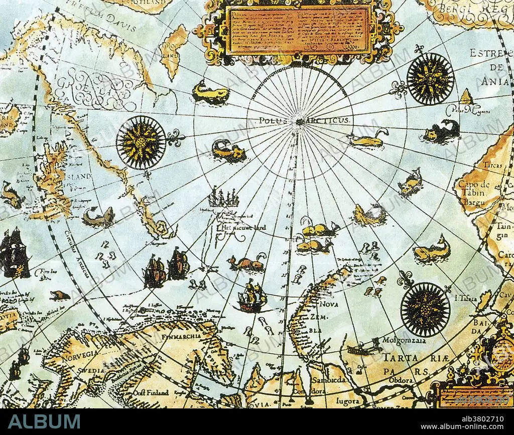
Arctic Map by William Barents, 1588
Caption:
A map of the Arctic compiled by Dutch navigator and explorer William Barents (c.1550-1597), who attempted to find the Northeast Passage from the Atlantic to the Pacific on several expeditions. Barents died in June 1597, trapped in pack ice off the coast of Novaja Zemlja after having discovered and circumnavigated the Spitsbergen archipelago. The Barents Sea, Barentsburg and Barents Region were all named after William Barents.
Credit:
Album / Science Source / New York Public Library
Releases:
Model: No - Property: No
Rights questions?
Rights questions?
Image size:
3834 x 3049 px | 33.4 MB
Print size:
32.5 x 25.8 cm | 12.8 x 10.2 in (300 dpi)
Keywords:
1500S • 1588 • 16 16TH XVI XVITH SIXTEENTH CENTURY • 16 CENTURY • 16TH CENTURY • 16TH • AGE OF DISCOVERY • ARCHIPELAGO • ARCTIC CIRCLE • ARCTIC REGION • ARCTIC • ART • ARTWORK • BARENTS • BARENTSZ • BARENTZ • BRITAIN • DISCOVERER • DRAWING • DUTCH • ENGLAND • ENGRAVING • EUROPEA • EUROPEAN • EUROPEANS • EXPEDITION • EXPLORATION • EXPLORER • FINLAND • GREENLAND • GREENLAND: GRL • HISTORIC • HISTORICAL • HISTORY • ILLUSTRATION • ILLUSTRATIONS • MAP • NORTH POLE • NORTHEAST PASSAGE • NORTHERN • NORWAY • NOVAYA ZEMLYA • POLAR • RESEARCHER (MALE) • RESEARCHER • SCANDINAVIA • SEA • SIBERIAN • SWEDEN • UNITED KINGDOM • WILLEM BARENTSZ • WILLIAM BARENTS • XVI CENTURY
