alb3909134
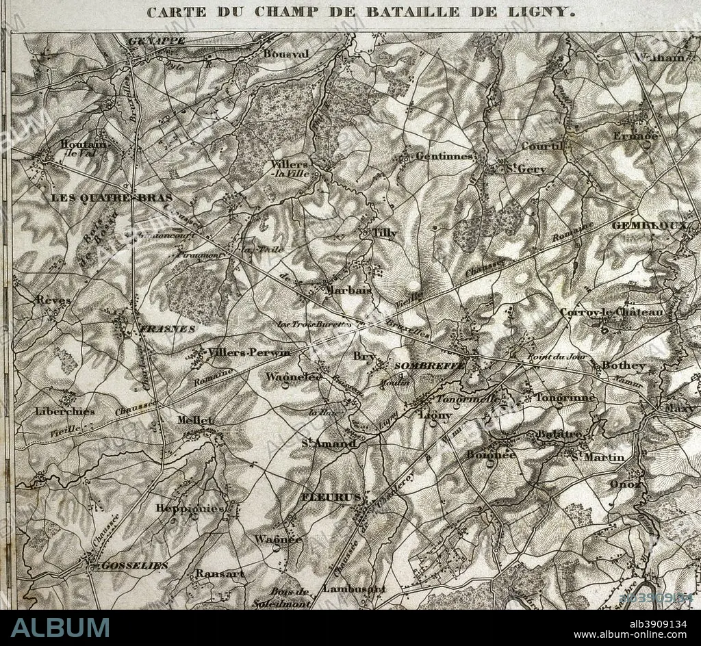
Map of the battlefield of Ligny, Belgium (16 June 1815). Part of the Waterloo Campaign. Commanders: France (Napoleon I), Prussia (Gebhard von Blucher). It was the last victory of Napoleon Bonaparte. Atlas de l'Histoire du Consulat et de l'Empire. History of the Consulate and the Empire of France under Napoleon by Marie Joseph Louis Adolphe Thiers (1797-1877). Drawings by Dufour, engravings by Dyonnet. Edited in Paris, 1864.
| Share |
|---|
 Pinterest Pinterest |
 Twitter Twitter |
 Facebook Facebook |
 Copy link Copy link |
 Email Email |
|
Add to another lightbox |
|
Add to another lightbox |


Buy this image.
Select the use:

Caption: Map of the battlefield of Ligny, Belgium (16 June 1815). Part of the Waterloo Campaign. Commanders: France (Napoleon I), Prussia (Gebhard von Blucher). It was the last victory of Napoleon Bonaparte. Atlas de l'Histoire du Consulat et de l'Empire. History of the Consulate and the Empire of France under Napoleon by Marie Joseph Louis Adolphe Thiers (1797-1877). Drawings by Dufour, engravings by Dyonnet. Edited in Paris, 1864.
Personalities: NAPOLÉON (1769-1821)
Credit: Album / Prisma
Releases: ? Model Release: No - ? Property Release: No
Rights questions?
Rights questions?
Image size: 4134 × 3598 px | 42.6 MB
Print size: 35.0 × 30.5 cm | 1627.6 × 1416.5 in (300 dpi)
Keywords: 1815 • 1864 • 19 CENTURY • 19TH CENTURY • 19TH CENTURY. • 19TH • 19TH-CENTURY • ADOLPHE THIERS • ANCIENT • ANTIQUE • ARMIES ARMY • ARMIES • ARMY'S • ARMY • ATLAS DE L'HISTOIRE DU CONSULAT ET DE L'EMPIRE • ATLAS DE L'HISTORIE DU CONSULAT ET DE L'EMPIRE • BATTLE OF LIGNY • BATTLE • BATTLEFIELD • BELGIEN • BELGIUM • BLUCHER • CARTOGRAPHY • COMBAT • COMBATTIMENTO • DESIGNING • DISPUTE • DOROGOBUZH • DRAWING • DRAWN • DUFOUR • DYONNET • EMPIRE • ENGRAVED • ENGRAVING (ARTWORK) • ENGRAVING • ENGRAVING. • ENGRAVINGS • ETCHING • EUROPA • EUROPE • EUROPEA • EUROPEAN • EUROPEANS • FIGHT • FIGHTING • FIRST FRENCH EMPIRE • FLEURUS • FRANCE • FRANCE. • FRANÇAIS • FRENCH EMPIRE • FRENCH VICTORY • FRENCH • GEBHARD VON BLUCHER • GEOGRAFIA • GEOGRAPHICAL • GEOGRAPHY • HISTORIA UNIVERSAL • HISTORIA • HISTORIC • HISTORICAL • HISTORY OF THE CONSULATE AND THE EMPIRE OF FRANCE UNDER NAPOLEON • HISTORY OF THE CONSULATE AND THE NAPOLEON EMPIRE • HISTORY • HISTORY. • ILLUSTRATION • ILLUSTRATIONS • ILUSTRATION • LA FRANCE • LIGNY • MAP MAKING • MAP • MAPS • MARIE JOSEPH LOUIS ADOLPHE THIERS • MODERN AGE • MODERN ERA • MODERN PERIOD • NAPOELON I • NAPOLEON I BONAPARTE • NAPOLEON I • NAPOLEON'S FRENCH EMPIRE • NAPOLEON • NAPOLEONIC EMPIRE • NAPOLEONIC MAP • NAPOLEONIC WAR • NAPOLEONIC WARS • NINETEENTH CENTURY • OLD • PART OF WATERLOO CAMPAIGN • PEACE, NAPOLEONIC WARS • PLAN (CARTOGRAPHY) • PLAN • PLANE • PRINCE BLUCHER • PRINT • PRUSIA • PRUSSIA • PRUSSIAN • SCUFFLE • SEVENTH COALITION • STRATEGIC • STRATEGY • STRUGGLE • SURFACE • TACTICAL • TERRITORY • THIERS • WAR OF THE SEVENTH COALITION • XIX CENTURY
