alb1655933
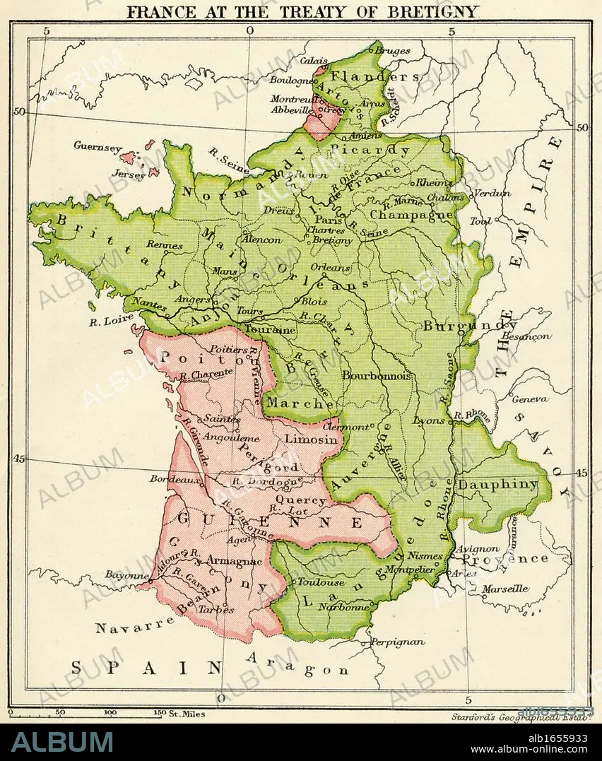
Map of France at the Treaty of Bretigny from A Short History of the English People by John Richard Green published by Macmillan and Co 1911.
| Share |
|---|
 Pinterest Pinterest |
 Twitter Twitter |
 Facebook Facebook |
 Copy link Copy link |
 Email Email |
|
Add to another lightbox |
|
Add to another lightbox |


Buy this image.
Select the use:

Caption:
Map of France at the Treaty of Bretigny from A Short History of the English People by John Richard Green published by Macmillan and Co 1911
Category:
UIG HISTORY
Credit:
Album / Universal History Archive/Universal Images Group
Releases:
Image size:
4016 x 4825 px | 55.4 MB
Print size:
34.0 x 40.9 cm | 13.4 x 16.1 in (300 dpi)
Keywords:
14TH FOURTEENTH • BRETIGNY • CARTOGRAPHY • CENTURY • COLOR • COLOUR • FLUSH • FRANCE • FRANCE. • FRENCH • HISTORIA UNIVERSAL • HISTORIA • HISTORY • HISTORY. • HUMANS • KEN • LA FRANCE • MAP MAKING • MAP • MAPS • PEOPLE • PLAN (CARTOGRAPHY) • TREATY • UIG HISTORY • VERTICAL LINES • VERTICAL • WELSH
