alb1962027
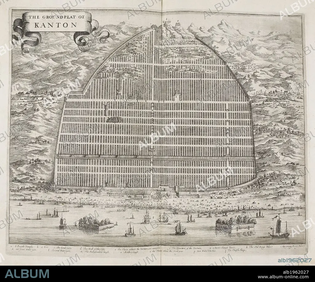
W BRAMSTON. The Ground Flat of Kanton. A map of the city of Canton in 1840. Street plan. China. . The Groundflat of Kanton. China. Canton. A Plan of the City of Canton and its Suburbs showing the principal Streets and some of the conspicuous Buildings from a Chinese Survey on an Enlarged Scale with additions and References, by W. Bramston, Late of Her Majesty’s Superintendents Office at Canton. Source: X.1202. Language: English.
| Share |
|---|
 Pinterest Pinterest |
 Twitter Twitter |
 Facebook Facebook |
 Copy link Copy link |
 Email Email |
|
Add to another lightbox |
|
Add to another lightbox |


Buy this image.
Select the use:

Author:
Caption:
The Ground Flat of Kanton. A map of the city of Canton in 1840. Street plan. China. . The Groundflat of Kanton. China. Canton. A Plan of the City of Canton and its Suburbs showing the principal Streets and some of the conspicuous Buildings from a Chinese Survey on an Enlarged Scale with additions and References, by W. Bramston, Late of Her Majesty’s Superintendents Office at Canton. Source: X.1202. Language: English.
Personalities:
Credit:
Album / British Library
Releases:
Model: No - Property: No
Rights questions?
Rights questions?
Image size:
4626 x 3894 px | 51.5 MB
Print size:
39.2 x 33.0 cm | 15.4 x 13.0 in (300 dpi)
Keywords:
19 CENTURY • 19TH CENTURY • 19TH CENTURY. • 19TH • 19TH-CENTURY • ARCHIVE • ARCHIVES • ASIA • BRAMSTON, W • CANTON • CARTOGRAPHY • CHINA • CHINE • CHINESE • CITIES • CITY • COLONIAL ERA • COLONIAL HISTORY • DATE BY CENTURY OF WORK OR SCENE • DOCUMENT • MAP MAKING • MAP • MAPS • NINETEENTH CENTURY • PERIOD BY DECADE OR ERA • PLAN (CARTOGRAPHY) • PLAN • PORCELAIN • STYLE AND PERIOD • TOWN • TOWNS • XIX CENTURY
