alb6092594
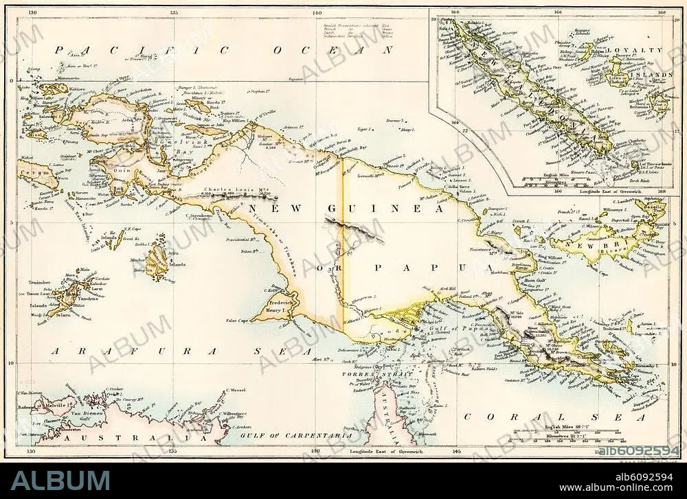
Map of New Guinea and New Caledonia,
| Share |
|---|
 Pinterest Pinterest |
 Twitter Twitter |
 Facebook Facebook |
 Copy link Copy link |
 Email Email |
|
Add to another lightbox |
|
Add to another lightbox |


Buy this image.
Select the use:

Title: Map of New Guinea and New Caledonia,
Caption: See automatic translation
Map of New Guinea and New Caledonia, 1870s. Printed color lithograph of a 19thcentury illustration
Map of New Guinea and New Caledonia, 1870s. Printed color lithograph of a 19thcentury illustration
Credit: Album / akg/North Wind Picture Archives
Releases: ? Model Release: No - ? Property Release: No
Rights questions?
Rights questions?
Image size: 3364 × 2269 px | 21.8 MB
Print size: 28.5 × 19.2 cm | 1324.4 × 893.3 in (300 dpi)
Keywords: 19 CENTURY • 19TH CENTURY • 19TH CENTURY. • 19TH • 19TH-CENTURY • ART • ARTS • ARTWORK • AUSTRALIA • BISMARCK ARCHIPELAGO • HISTORIA UNIVERSAL • HISTORIA • HISTORY • HISTORY. • ILLUSTRATION • ILLUSTRATIONS • ILUSTRATION • ISLA • ISLAND • ISLANDS • LEGEND • MAP • MAPS • MELANESIA • NEW CALEDONIA • NEW GUINEA • NINETEENTH CENTURY • OCEAN • OCEANIA • PACIFIC OCEAN • PACIFIC • PHOTOGRAPH • PHOTOGRAPHY • PLAN (CARTOGRAPHY) • STORY USES • WORK OF ART • XIX CENTURY
