alb9389679
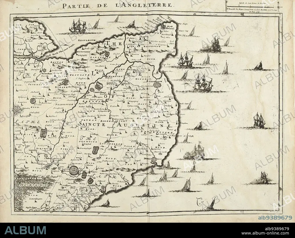
Map of Southwest England, 1709, Partie de l'Angleterre (title on object), Map of Southwest England, 1709. Part of a bundled collection of plans of battles and cities renowned in the War of the Spanish Succession. This plate is among the first 24 plates that make up a very large map of the Southern Netherlands., print maker: Jacobus Harrewijn (mentioned on object), publisher: Eugene Henry Fricx (mentioned on object), Brussels, 1709, paper, etching, height 445 mm × width 565 mm.
| Share |
|---|
 Pinterest Pinterest |
 Twitter Twitter |
 Facebook Facebook |
 Copy link Copy link |
 Email Email |
|
Add to another lightbox |
|
Add to another lightbox |


Buy this image.
Select the use:

Caption:
Map of Southwest England, 1709, Partie de l'Angleterre (title on object), Map of Southwest England, 1709. Part of a bundled collection of plans of battles and cities renowned in the War of the Spanish Succession. This plate is among the first 24 plates that make up a very large map of the Southern Netherlands., print maker: Jacobus Harrewijn (mentioned on object), publisher: Eugene Henry Fricx (mentioned on object), Brussels, 1709, paper, etching, height 445 mm × width 565 mm
Personalities:
Credit:
Album / quintlox
Releases:
Image size:
5560 x 4188 px | 66.6 MB
Print size:
47.1 x 35.5 cm | 18.5 x 14.0 in (300 dpi)
Keywords:
1709 • BATTLES • BRUSSELS • BUNDLED COLLECTION • CITIES RENOWNED • CITY OF BRUSSELS • DISH • ETCHING • EUGENE HENRY FRICX • FIRST 24 PLATES • GUERRA • HEIGHT 445 MM • HUNDRED YEARS WAR • JACOBUS HARREWIJN • LARGE MAP • MAP • MAPS • MENTIONED • PAPER AND PACKAGE PRODUCTS • PAPER • PART • PARTIE DE L'ANGLETERRE • PLAN (CARTOGRAPHY) • PLANS • PLATE • PRINT MAKER • PUBLISHER • SOUTHERN NETHERLANDS • SOUTHWEST ENGLAND • SPANISH SUCCESSION • UP A • WAR • WARFARE • WARS • WIDTH 565 MM
