alb5531942
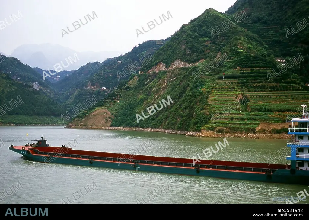
China: Coal boat, Xiling Gorge (Xiling Xia), the Three Gorges, Yangtze (Yangzi) River, Hubei Province.
| Share |
|---|
 Pinterest Pinterest |
 Twitter Twitter |
 Facebook Facebook |
 Copy link Copy link |
 Email Email |
|
Add to another lightbox |
|
Add to another lightbox |


Buy this image.
Select the use:

Title:
China: Coal boat, Xiling Gorge (Xiling Xia), the Three Gorges, Yangtze (Yangzi) River, Hubei Province.
Caption:
The Three Gorges or Yangtze Gorges span from the western—upriver cities of Fengjie and Yichang in Chongqing Municipality eastward—downstream to Hubei province. The Yangtze River (Chang Jiang)—Three Gorges region has a total length of approximately 200 kilometres (120 mi). The Three Gorges occupy approximately 120 kilometres (75 mi) within this region. The Chang Jiang (Yangzi River) is the longest river in China and third longest in the world. Known upstream as the Golden Sand River, it flows through the geographical, spiritual and historical heart of China. From its source in the Tanggula Mountains of Qinghai province, the Yangzi flows southeast through Tibet as the Tongtian, turns south, then north as the Jinsha, and becomes the Yangzi proper after Yibin in Sichuan. Here, it swings eastwards once again, crossing Hubei, Hunan, Jiangxi, Anhui and Jiangsu provinces to reach the East China Sea at Shanghai. Its source-to-mouth length is 6,300 km (3,915 miles).
Credit:
Album / David Henley/Pictures from History/Universal Images Group
Releases:
Model: No - Property: No
Rights questions?
Rights questions?
Image size:
5100 x 3360 px | 49.0 MB
Print size:
43.2 x 28.4 cm | 17.0 x 11.2 in (300 dpi)
Keywords:
ASIA IMAGES • ASIA PICTURES • ASIA • ASIAN IMAGE • ASIAN IMAGES • ASIAN PICTURES • ASIAN • BOAT • BOATS • CHANG JIANG • CHINA • CHINE • CHINESE • COAL • DAM • DAVID HENLEY • GORGE • HISTORIA UNIVERSAL • HISTORIA • HISTORICAL IMAGES • HISTORICAL PICTURES • HISTORICAL • HISTORY IMAGES • HISTORY PICTURES • HISTORY • PORCELAIN • RIVER • SHIP • SHIPS • THREE GORGES • VESSEL • XILING GORGE • XILING • YANGTZE • YANGZI
