alb4631429
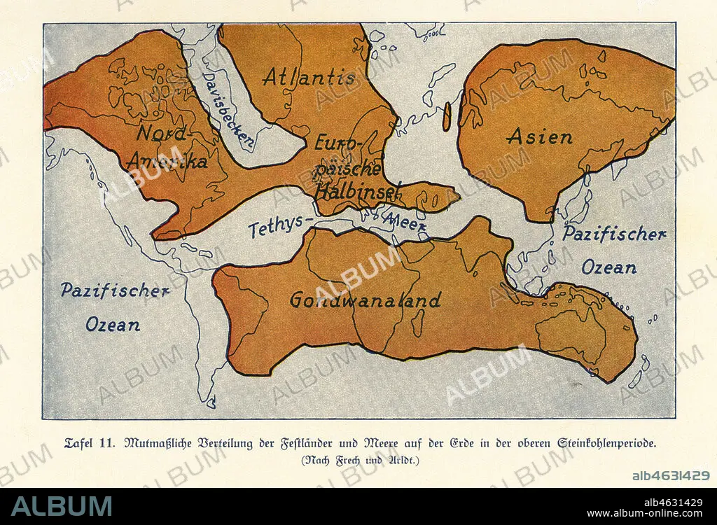
Map of the continents and seas in the Upper Carboniferous era. Atlantis, North America, Asia, European Peninsula, Gondwanaland. Colour print after an illustration from Wilhelm Bolsches Das Leben der Urwelt, Prehistoric Life, Georg Dollheimer, Leipzig, 1932.
| Share |
|---|
 Pinterest Pinterest |
 Twitter Twitter |
 Facebook Facebook |
 Copy link Copy link |
 Email Email |
|
Add to another lightbox |
|
Add to another lightbox |


Buy this image.
Select the use:

Caption: Map of the continents and seas in the Upper Carboniferous era. Atlantis, North America, Asia, European Peninsula, Gondwanaland. Colour print after an illustration from Wilhelm Bolsches Das Leben der Urwelt, Prehistoric Life, Georg Dollheimer, Leipzig, 1932.
Credit: Album / Florilegius
Releases: ? Model Release: No - ? Property Release: No
Rights questions?
Rights questions?
Image size: 6770 × 4608 px | 89.3 MB
Print size: 57.3 × 39.0 cm | 2665.4 × 1814.2 in (300 dpi)
Keywords: AMERICA NORTH • ASIA • ATLANTIDA • ATLANTIS • COLOUR PRINT • CONTINENTS • DAS LEBEN DER URWELT • DINOSAURS • EUROPEAN PENINSULA • EXTINCT • FLEET • GONDWANALAND • ILLUSTRATION • ILLUSTRATIONS • ILUSTRATION • MAP • MAPS • MARINE CREATURE • MARINE • NAVY • NORTH AMERICA • NORTH AMERICAN • OCEAN • OCEANS • PALAEONTOLOGY • PALEONTOLOGY • PLAN (CARTOGRAPHY) • PREHISTORIC LIFE • PREHISTORY • SEA • SEA. • SEAS • UPPER CARBONIFEROUS • WILHELM BOLSCHE • ZOOLOGY
