alb6092579
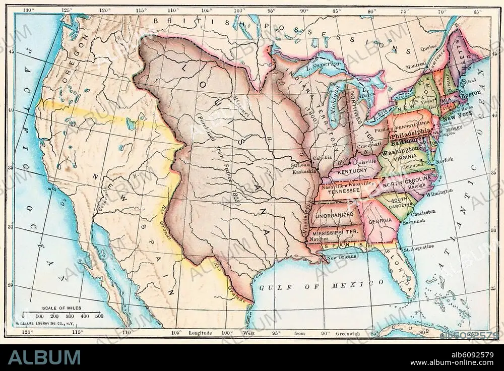
Map of the Louisiana Purchase as
| Share |
|---|
 Pinterest Pinterest |
 Twitter Twitter |
 Facebook Facebook |
 Copy link Copy link |
 Email Email |
|
Add to another lightbox |
|
Add to another lightbox |


Buy this image.
Select the use:

Title:
Map of the Louisiana Purchase as
Caption:
See automatic translation
Map of the Louisiana Purchase as understood in 1803, later modified by treaty. Printed color lithograph of a 19thcentury illustration
Credit:
Album / akg/North Wind Picture Archives
Releases:
Image size:
3364 x 2299 px | 22.1 MB
Print size:
28.5 x 19.5 cm | 11.2 x 7.7 in (300 dpi)
Keywords:
19 CENTURY • 19TH CENTURY • 19TH CENTURY. • 19TH • 19TH-CENTURY • ART • ARTS • ARTWORK • EE. UU. • ESTADOS UNIDOS USA EEUU EE. UU. EUA E. U. A. • EXPEDITION • HISTORIA UNIVERSAL • HISTORIA • HISTORY • HISTORY. • ILLUSTRATION • ILLUSTRATIONS • ILUSTRATION • LEGEND • LOUISIANA • MAP • MAPS • NINETEENTH CENTURY • NORTH AMERICA • OREGON • PHOTOGRAPH • PHOTOGRAPHY • PLAN (CARTOGRAPHY) • STORY USES • U. S. A. • U.S. • UNITED STATES OF AMERICA • UNITED STATES • UNITED STATES, THE • UNITES STATES OF AMERICA USA • USA • WORK OF ART • XIX CENTURY
