alb6386975
Römisches Reich im 3.Jh. / Landkarte
| Share |
|---|
 Pinterest Pinterest |
 Twitter Twitter |
 Facebook Facebook |
 Copy link Copy link |
 Email Email |
|
Add to another lightbox |
|
Add to another lightbox |


Title:
Römisches Reich im 3.Jh. / Landkarte
Caption:
See automatic translation
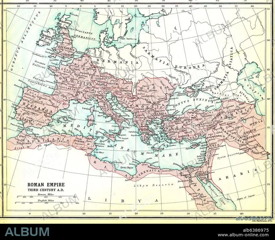
Europa / Landkarten:-"Roman Empire third century A.D.".-(Das Römische Reich im 3.Jh. n.Chr.) Aus: Atlas of the Historical Geography of the Holy Land. Designed and edited by George Adam Smith and prepared unter the direction of J.G. Bartholomew. London, Hodder and Stroughton, 1915.
Project:
ATLAS OF THE HISTORICAL GEOGRAPHY OF THE HOLY LA
Artwork date:
1915
Event date:
250
Credit:
Album / akg-images
Releases:
Model: No - Property: No
Rights questions?
Rights questions?
Image size:
2463 x 2007 px | 14.1 MB
Print size:
20.9 x 17.0 cm | 8.2 x 6.7 in (300 dpi)
Keywords:
1910S • 20 XX TWENTIETH CENTURY • 20TH CENTURY • 20TH • 3RD CENTURY A. D. • 3RD CENTURY AD • 3RD CENTURY • A. D. 3RD CENTURY • ANCIENT WORLD • ANTIGUEDAD • ANTIQUITIES • ANTIQUITY • ATLAS OF THE HISTORICAL GEOGRAPHY OF THE HOLY LA • ATLAS • ATLASES • BARTHOLOMEW, J. G. • CARTOGRAPHY • COMMON • EUROPE (GEOGRAPHY) • EUROPE • GENERAL • GEOGRAPHY • MAP MAKING • MAP • MAPS • MEDITERRANEAN SEA • PLAN (CARTOGRAPHY) • ROMAN EMPIRE • S. III DC • S. III • SIGLO III D. C. • SMITH, GEORGE ADAM • THIRD CENTURY • TOPOGRAPHY • TWENTIETH CENTURY
