alb4061296
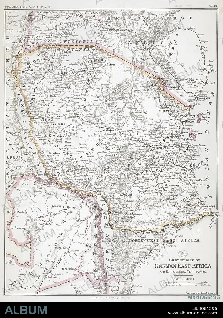
First World War sketch map of German East Africa, 1916. Stanford's War Maps. No. 14. Sketch map of German East Africa and surrounding territories. Scale, 1 : 2,587,000. 27 January 1916. Source: Maps.1035.(90) no.15.
| Share |
|---|
 Pinterest Pinterest |
 Twitter Twitter |
 Facebook Facebook |
 Copy link Copy link |
 Email Email |
|
Add to another lightbox |
|
Add to another lightbox |


Buy this image.
Select the use:

Caption: First World War sketch map of German East Africa, 1916. Stanford's War Maps. No. 14. Sketch map of German East Africa and surrounding territories. Scale, 1 : 2,587,000. 27 January 1916. Source: Maps.1035.(90) no.15.
Credit: Album / British Library
Releases: ? Model Release: No - ? Property Release: No
Rights questions?
Rights questions?
Image size: 6008 × 8136 px | 139.8 MB
Print size: 50.9 × 68.9 cm | 2365.4 × 3203.1 in (300 dpi)
Keywords: 1ST WORLD WAR • 20 20TH XX XXTH TWENTIETH CENTURY • 20 XX TWENTIETH CENTURY • 20TH CENTURY • 20TH • AFRICA • AFRICAN • ARMED CONFLICT • ARMED CONFLICTS • CARTE • CARTOGRAPHIC • CARTOGRAPHY • CHART • COMBAT • EAST AFRICA • EASTERN AFRICA • EVENT • EVENTS • FIRST WORLD WAR • GREAT WAR • GUERRA • HUNDRED YEARS WAR • I WORLD WAR • MAP MAKING • MAP • MAPS • MILITARY EVENT • MILITARY EVENTS • PLAN (CARTOGRAPHY) • TWENTIETH CENTURY • WAR • WARFARE • WARS • WORLD WAR 1 • WORLD WAR I (1914-18) • WORLD WAR I • WORLD WAR ONE • WORLD WAR • WW1 • WWI
