alb4546903
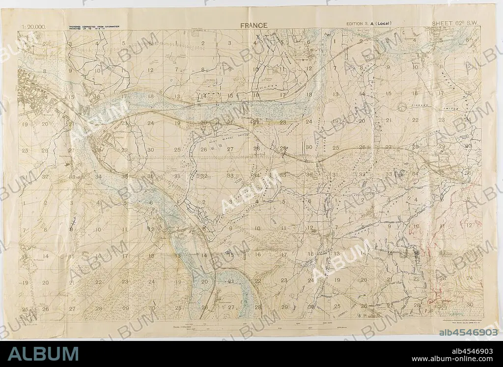
Map - Military, Trench, France, Sheet 62D SW, Scale 1:20,000, Edition 3A, World War I, 18 Jun 1918, One of two copies of a military trench map, France, sheet 62 D. S. W., edition 3.A., (local) scale 1:20,000. Trenches corrected from information received up to 15 June 1918. Field Survey Co., R. E. (3808), dated 18 June 1918. The map depicts the Somme River area to the east and south-east of Amiens, including Villers Bretonneux. Used by Capt. M. Lewis during World War I. Captain Morris Lewis,.
| Share |
|---|
 Pinterest Pinterest |
 Twitter Twitter |
 Facebook Facebook |
 Copy link Copy link |
 Email Email |
|
Add to another lightbox |
|
Add to another lightbox |


Caption:
Map - Military, Trench, France, Sheet 62D SW, Scale 1:20,000, Edition 3A, World War I, 18 Jun 1918, One of two copies of a military trench map, France, sheet 62 D. S. W., edition 3.A., (local) scale 1:20,000. Trenches corrected from information received up to 15 June 1918. Field Survey Co., R. E. (3808), dated 18 June 1918. The map depicts the Somme River area to the east and south-east of Amiens, including Villers Bretonneux. Used by Capt. M. Lewis during World War I. Captain Morris Lewis,
Personalities:
Credit:
Album / quintlox
Releases:
Model: No - Property: No
Rights questions?
Rights questions?
Image size:
3900 x 2642 px | 29.5 MB
Print size:
33.0 x 22.4 cm | 13.0 x 8.8 in (300 dpi)
Keywords:
000 • 15 JUNE 1918 • 18 JUN 1918 • 1ST WORLD WAR • 20 • 3808 • AMIENS • CAPT • CAPTAIN MORRIS LEWIS • DATED 18 JUNE 1918 • E • EAST • EDITION 3. A • EDITION 3A • FIELD SURVEY CO • FIRST WORLD WAR • FRANCE • INFORMATION RECEIVED UP • LEWIS • LOCAL • M • MAP DEPICTS • MAP • MAPS • MILITARY TRENCH MAP • MILITARY • ORIENT • PLAN (CARTOGRAPHY) • R • S • SCALE 1 • SHEET 62 D • SHEET 62D SW • SOMME RIVER AREA • SOUTH-EAST • TRENCH • TRENCHES CORRECTED • TWO COPIES • VILLERS BRETONNEUX • W • WORLD WAR I (1914-18) • WORLD WAR I • WORLD WAR ONE • WWI
