alb5407509
Joan Blaeu, Madagascar Map, 17th Century
| Share |
|---|
 Pinterest Pinterest |
 Twitter Twitter |
 Facebook Facebook |
 Copy link Copy link |
 Email Email |
|
Add to another lightbox |
|
Add to another lightbox |


Title:
Joan Blaeu, Madagascar Map, 17th Century
Caption:
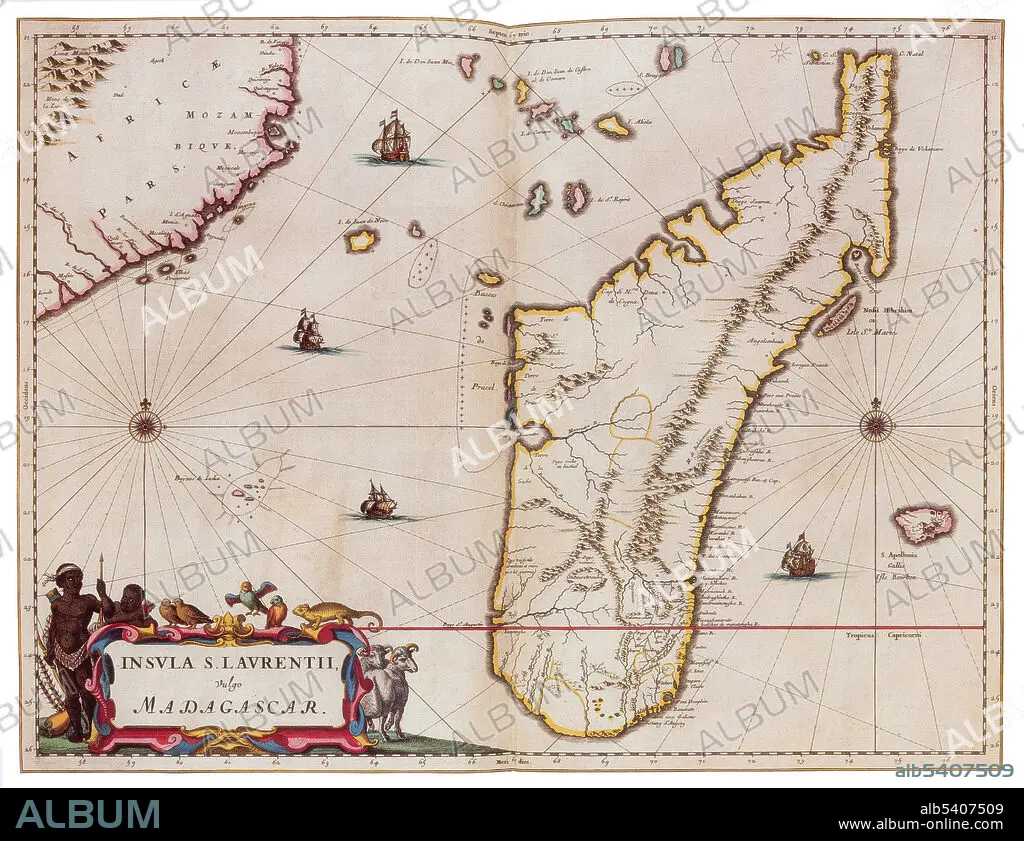
Madagascar is an island country in the Indian Ocean, off the coast of East Africa. The nation comprises the island of Madagascar, and numerous smaller peripheral islands. Following the prehistoric breakup of the supercontinent Gondwana, Madagascar split from the Indian peninsula around 88 million years ago, allowing native plants and animals to evolve in relative isolation. Madagascar is a biodiversity hotspot, over 90% of its wildlife is found nowhere else on Earth. Joan Blaeu (1596-1673) was a Dutch cartographer, the son of cartographer Willem Blaeu. In 1635 they published the Atlas Novus (full title: Theatrum orbis terrarum, sive, Atlas novus) in two volumes. The Atlas Maior is the final version of Joan Blaeu's atlas, published in Amsterdam between 1662 and 1672, in Latin, French, Dutch, German and Spanish, containing 594 maps and around 3,000 pages of text. The Blaeu maps emphasized fine art and colours, being the most expensive of the time.
Credit:
Album / Science Source
Releases:
Model: No - Property: No
Rights questions?
Rights questions?
Image size:
4200 x 3231 px | 38.8 MB
Print size:
35.6 x 27.4 cm | 14.0 x 10.8 in (300 dpi)
Keywords:
1600S • 17TH CENTURY • 17TH • AFRICA • AFRICAN CONTINENT • AFRICAN • AGE • ÂGÉS • ATLAS • BLAEU • CARTOGRAPHIC • CARTOGRAPHICAL • CARTOGRAPHY • CELEBRITIES • CELEBRITY • CENTURY • DUTCH / NETHERLANDISH • DUTCH • EAST • FAMOUS • FLEET • GEOGRAPHIC • GEOGRAPHICAL • GEOGRAPHY • GOLDEN • HISTORIC • HISTORICAL • HISTORY • IMPORTANT • INDIAN • INDIGENOUS PEOPLES OF THE AMERICAS • INDIO • INFLUENTIAL • ISLAND • JOAN • MADAGASCAR • MAKING • MAP MAKING • MAP • MAP-MAKING • MAPMAKING • MARINE • NAVY • NOTABLE • NOVUS • OCEAN • OF • OLD • ORIENT • SEA • SEAS • SEVENTEETH • WELL-KNOWN • XVII CENTURY
