alb9507328
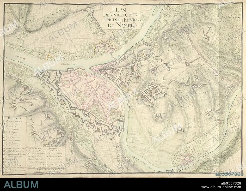
Map of Namur, ca. 1701-1715, Nicolas Suly, 1701 - 1715, Map of the fortifications around the city of Namur with the castle, ca. 1701-1715. Bottom left legend A-Z and 1-13 in French. Part of a collection of drawn plans of fortified towns in the Netherlands and surrounding countries at the time of the War of the Spanish Succession (part B)., draughtsman: Nicolas Suly, (mentioned on object), Netherlands, 1701 - 1715, paper, h 530 mm × w 730 mm.
| Share |
|---|
 Pinterest Pinterest |
 Twitter Twitter |
 Facebook Facebook |
 Copy link Copy link |
 Email Email |
|
Add to another lightbox |
|
Add to another lightbox |


Buy this image.
Select the use:

Caption:
Map of Namur, ca. 1701-1715, Nicolas Suly, 1701 - 1715, Map of the fortifications around the city of Namur with the castle, ca. 1701-1715. Bottom left legend A-Z and 1-13 in French. Part of a collection of drawn plans of fortified towns in the Netherlands and surrounding countries at the time of the War of the Spanish Succession (part B)., draughtsman: Nicolas Suly, (mentioned on object), Netherlands, 1701 - 1715, paper, h 530 mm × w 730 mm
Credit:
Album / quintlox
Releases:
Model: No - Property: No
Rights questions?
Rights questions?
Image size:
6086 x 4418 px | 76.9 MB
Print size:
51.5 x 37.4 cm | 20.3 x 14.7 in (300 dpi)
Keywords:
1-13 • 1701-1715 • BOTTOM LEFT LEGEND A-Z • CASTLE • CASTLES • CITY • COLLECTION • DRAFTSMAN • DRAUGHTSMAN • DRAWN PLANS • FORTIFICATIONS • FORTIFIED TOWNS • FRENCH • H 530 MM × W 730 MM • HUNDRED YEARS WAR • MAP • MAPS • MENTIONED • NAMUR • NETHERLANDS • NICOLAS SULY • OBJECT • OBJECTS • PAPER AND PACKAGE PRODUCTS • PAPER • PART B • PART • PLAN (CARTOGRAPHY) • SPANISH SUCCESSION • SURROUNDING COUNTRIES • TIME • TOWN • TOWNS • UMBRELLA • WAR • WARFARE • WARS • ÇA
