alb3801496
Atlas of al-Idrisi
| Share |
|---|
 Pinterest Pinterest |
 Twitter Twitter |
 Facebook Facebook |
 Copy link Copy link |
 Email Email |
|
Add to another lightbox |
|
Add to another lightbox |


Buy this image.
Select the use:

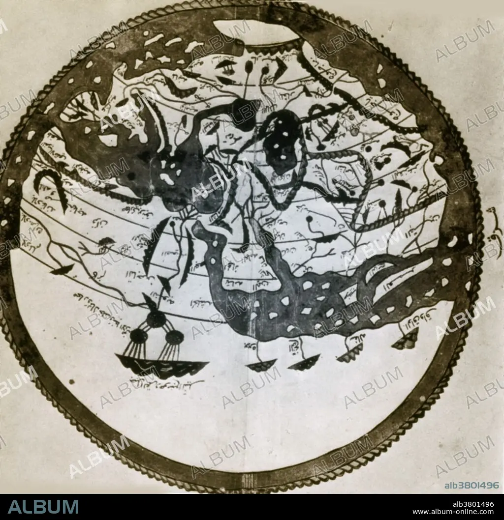
Title: Atlas of al-Idrisi
Caption: Arab geographers understood the outlines of Asia, Europe and North Africa by VI/12th century; their knowledge was summed up by the great atlas of al-Idrisi of 549/1154. It places south at the top; the map is inverted to make it easily recognizable.
Personalities: CONTINENTAL
Category: SCIENCE • History: Ancient
Credit: Album / Science Source / New York Public Library
Releases: ? Model Release: No - ? Property Release: No
Rights questions?
Rights questions?
Image size: 3384 × 3321 px | 32.2 MB
Print size: 28.7 × 28.1 cm | 1332.3 × 1307.5 in (300 dpi)
Keywords: AL-IDRISI • ARAB • ARABE • ARABIAN • ARABIC • ARABS • ART • ARTWORK • CARDS • CARTOGRAPHY • CHART • CHARTS • COLORIZED • CONTINENT • CONTINENTAL • CONTINENTS • COSMOGRAPHIA • DRAWING • ENHANCEMENT • GEOGRAFIA • GEOGRAPHIC • GEOGRAPHY • HISTORIC MAP • HISTORIC • HISTORICAL • HISTORY • HISTORY: ANCIENT • ILLUSTRATION • ILLUSTRATIONS • ILUSTRATION • ISLAMIC • MAP MAKING • MAP • MIDDLE EAST • SCI • SCIENCE AND TECHNOLOGY WISSENSCHAFT SCI • SCIENCE • SCIENCE-TECHNOLOGY • SCIENCE_AND_TECHNOLOGY WISSENSCHAFT SCI
