alb1658040
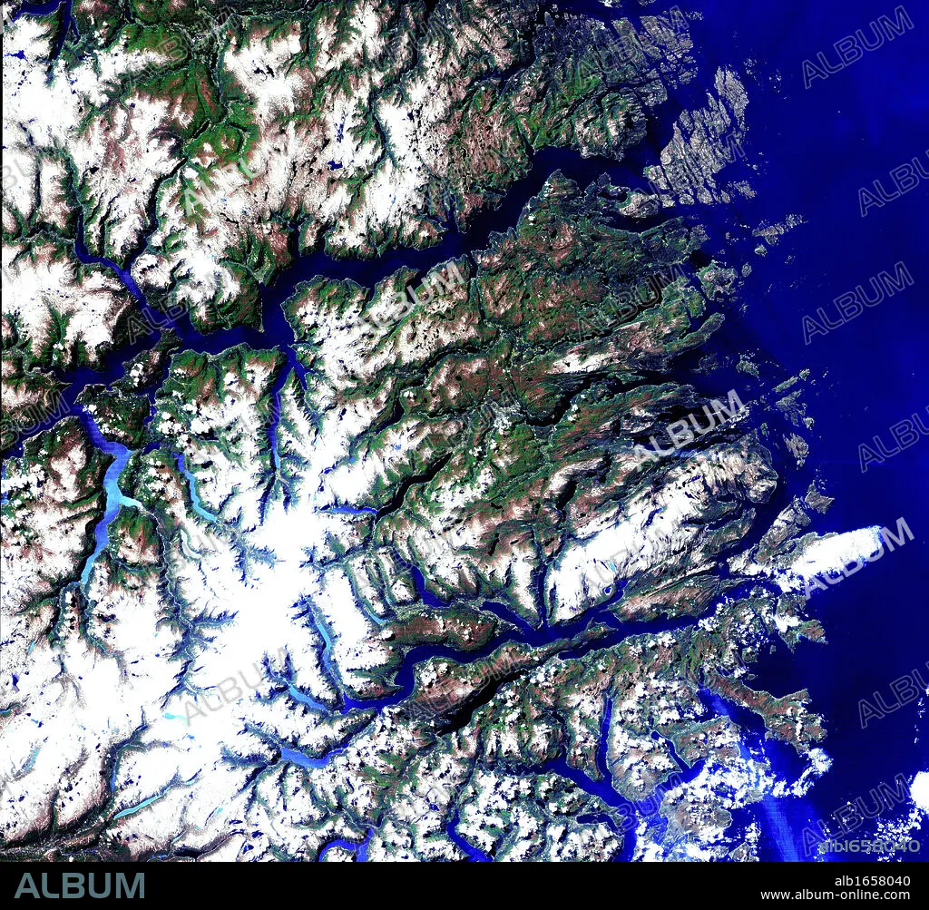
Satellite view of the Norwegian fjords: Sogn og Fjordane, west coast of Norway. US Geological Survey. Science.
| Share |
|---|
 Pinterest Pinterest |
 Twitter Twitter |
 Facebook Facebook |
 Copy link Copy link |
 Email Email |
|
Add to another lightbox |
|
Add to another lightbox |


Caption:
Satellite view of the Norwegian fjords: Sogn og Fjordane, west coast of Norway. US Geological Survey. Science
Credit:
Album / Universal History Archive/Universal Images Group
Releases:
Model: No - Property: No
Rights questions?
Rights questions?
Image size:
4411 x 4092 px | 51.6 MB
Print size:
37.3 x 34.6 cm | 14.7 x 13.6 in (300 dpi)
Keywords:
CIENCIA • COAST • FJORDANE • FJORDS • GEOLOGICAL • NORWAY • NORWEGIAN • OG • PANORAMIC VIEW • PHOTOGRAPH • SATELLITE • SCIENCE • SOGN • STANDPOINT • SURVEY • US • VIEWPOINT • WEST
