alb1642906
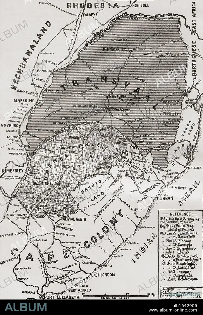
Map of The Boer Republics at the end of the 19th century. From the book South Africa and the Transvaal War, Volume 1 by Louis Creswicke, published 1900.
| Share |
|---|
 Pinterest Pinterest |
 Twitter Twitter |
 Facebook Facebook |
 Copy link Copy link |
 Email Email |
|
Add to another lightbox |
|
Add to another lightbox |


Buy this image.
Select the use:

Caption:
Map of The Boer Republics at the end of the 19th century. From the book South Africa and the Transvaal War, Volume 1 by Louis Creswicke, published 1900.
Category:
UIG HISTORY
Credit:
Album / Universal History Archive/Universal Images Group
Releases:
Image size:
3627 x 5350 px | 55.5 MB
Print size:
30.7 x 45.3 cm | 12.1 x 17.8 in (300 dpi)
Keywords:
19 CENTURY • 19TH CENTURY • 19TH CENTURY. • 19TH • 19TH-CENTURY • 2ND • AFRICA • AFRICAN • ANGLO-BOER • BASUTO • BOER • CAPE • CENTURY • COLONY • CONFLICT • CONFLICTS • FREE • GUERRA • HUNDRED YEARS WAR • KEN • LAND • MAP • MAPMAKING • MAPS • NINETEENTH CENTURY • ORANGE • ORANGES • PLAN (CARTOGRAPHY) • REPUBLIC • REPUBLICS • SECOND • SOUTH • STATE • TRANSVAAL • UIG HISTORY • WAR • WARFARE • WARS • WELSH • XIX CENTURY
