alb9008177
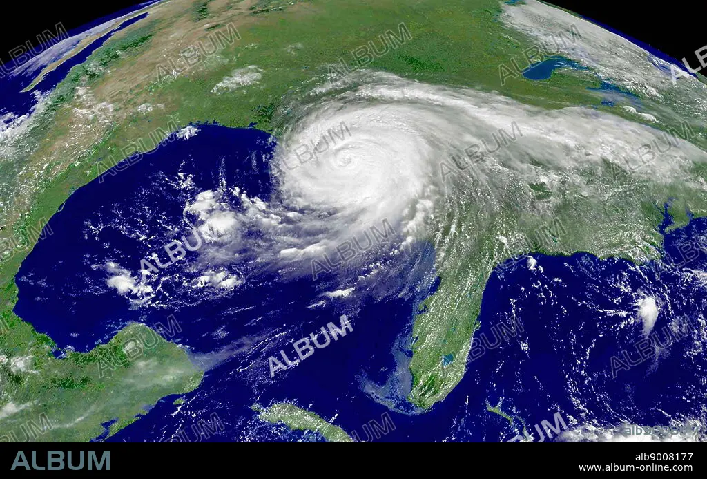
satellite image of Hurricane Katrina; 2005
| Share |
|---|
 Pinterest Pinterest |
 Twitter Twitter |
 Facebook Facebook |
 Copy link Copy link |
 Email Email |
|
Add to another lightbox |
|
Add to another lightbox |


Buy this image.
Select the use:

Title: satellite image of Hurricane Katrina; 2005
Caption: Hurricane Katrina making landfall on the U.S. Gulf Coast. Hurricane Katrina caused severe destruction along the Gulf coast from central Florida to Texas, much of it due to the storm surge and levee failure. The storm is the third most intense United States landfalling tropical cyclone, at least 1,245 people died in the hurricane and subsequent floods, making it the deadliest United States hurricane since the 1928 Okeechobee hurricane. Total property damage was estimated at $108 billion
Credit: Album / World History Archive
Releases: ? Model Release: No - ? Property Release: No
Rights questions?
Rights questions?
Image size: 5793 × 3620 px | 60.0 MB
Print size: 49.0 × 30.6 cm | 2280.7 × 1425.2 in (300 dpi)
