alb2219810
Pennsylvania Central-1854 1854
| Share |
|---|
 Pinterest Pinterest |
 Twitter Twitter |
 Facebook Facebook |
 Copy link Copy link |
 Email Email |
|
Add to another lightbox |
|
Add to another lightbox |


Buy this image.
Select the use:

Title:
Pennsylvania Central-1854 1854
Caption:
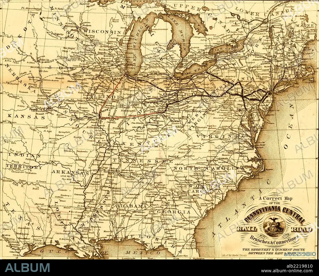
Pennsylvania Central - 1854; map of the eastern United States showing the railroad network and emphasizing the routes between St. Louis and Chicago, and Baltimore, Philadelphia, and New York.
Credit:
Album / Universal Images Group / Universal History Archive/UIG
Releases:
Image size:
2740 x 2225 px | 17.4 MB
Print size:
23.2 x 18.8 cm | 9.1 x 7.4 in (300 dpi)
Keywords:
1854 • CARTOGRAPHIC • CARTOGRAPHY • COAST • JOURNEY • JOURNEYMAN'S TRAVEL • JOURNEYMAN'S TRAVELS • LEISURE • MAP MAKING • MAP • MAPS • PACIFIC • PLAN (CARTOGRAPHY) • RAIL • RAILROAD • RAILS • RAILWAY • ROUTES • STEAM BOAT • STEAM SHIP • STEAMBOAT • STEAMSHIP • THRIP • TO TRAVEL • TRAIN • TRAINS • TRAIT • TRANSPORTATION • TRAVEL • TRAVELING • TRAVELS • TRIP • TRIPS • VOYAGE
