alb4552031
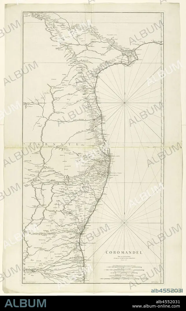
Map of Coromandel, Coromandel / par le Sr d'Anville (title on object), Map of the coast of Coromandel from mo Nega-Patnam to r.b. Narsapur, l.o. scale in French miles, nautical miles, regular Coss, large Coss and miles from Malabar. (Coss is an Indian length measure), maps of separate countries or regions, Coromandel coast, Jean Baptiste Bourguignon d'Anville (mentioned on object), Paris, Jan-1753, paper, engraving, h 960 mm × w 500 mm.
| Share |
|---|
 Pinterest Pinterest |
 Twitter Twitter |
 Facebook Facebook |
 Copy link Copy link |
 Email Email |
|
Add to another lightbox |
|
Add to another lightbox |


Buy this image.
Select the use:

Caption:
Map of Coromandel, Coromandel / par le Sr d'Anville (title on object), Map of the coast of Coromandel from mo Nega-Patnam to r.b. Narsapur, l.o. scale in French miles, nautical miles, regular Coss, large Coss and miles from Malabar. (Coss is an Indian length measure), maps of separate countries or regions, Coromandel coast, Jean Baptiste Bourguignon d'Anville (mentioned on object), Paris, Jan-1753, paper, engraving, h 960 mm × w 500 mm
Credit:
Album / quintlox
Releases:
Model: No - Property: No
Rights questions?
Rights questions?
Image size:
3765 x 6000 px | 64.6 MB
Print size:
31.9 x 50.8 cm | 12.6 x 20.0 in (300 dpi)
Keywords:
COAST • COROMANDEL COAST • COROMANDEL • COSS • ENGRAVED • ENGRAVING (ARTWORK) • ENGRAVING • ENGRAVING. • ENGRAVINGS • ETCHING • FRENCH MILES • INDIAN LENGTH MEASURE • JAN-1753 • JEAN BAPTISTE BOURGUIGNON D'ANVILLE • L O • LARGE COSS • MALABAR • MAP • MAPS • MENTIONED • MILES • MO NEGA-PATNAM • NARSAPUR • NAUTICAL MILES • OBJECT • OBJECTS • PAPER AND PACKAGE PRODUCTS • PAPER • PAR LE SR D'ANVILLE • PARIS • PLAN (CARTOGRAPHY) • PRINT • R B • REGIONS • REGULAR COSS • SCALE • SEPARATE COUNTRIES • TITLE • UMBRELLA
