alb3836471
Lau Basin Volcanic Region, Bathymetric Map
| Share |
|---|
 Pinterest Pinterest |
 Twitter Twitter |
 Facebook Facebook |
 Copy link Copy link |
 Email Email |
|
Add to another lightbox |
|
Add to another lightbox |


Buy this image.
Select the use:

Title:
Lau Basin Volcanic Region, Bathymetric Map
Caption:
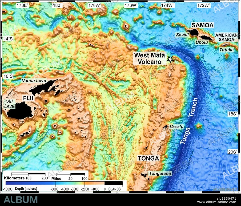
The Lau Basin is located in the southwest Pacific, within an area bounded by Samoa, Tonga and Fiji (the black areas on the map, which are the only areas above water). The area is home to many submarine volcanoes, such as West Mata.
Category:
Geology & Fossils
Credit:
Album / NOAA/Science Source
Releases:
Image size:
5512 x 4428 px | 69.8 MB
Print size:
46.7 x 37.5 cm | 18.4 x 14.8 in (300 dpi)
Keywords:
3D • ACTIVE • BATHYMETRIC • BATHYMETRY • DEEP • DEEP-OCEAN • DEEP-SEA • FIJI • FLEET • GEOLOGY & FOSSILS • HYDROTHERMAL VENT • LAU BASIN • MAP • MAPPING • MARINE • NAVY • OCEAN FLOOR • OCEAN • OCEAN, PACIFIC • OCEANS • PACIFIC OCEAN • PACIFIC • SAMOA • SEA • SEA. • SEAS • SONAR IMAGE • SONAR MAP • SONAR • TONGA TRENCH • TONGA • TOPOGRAPHIC • TOPOGRAPHY • UNDERSEA • UNDERWATER • VENT • VOLCANISM • VOLCANO • VULCAN • VULCANO • WATER • WEST MATA VOLCANO
