alb1748440
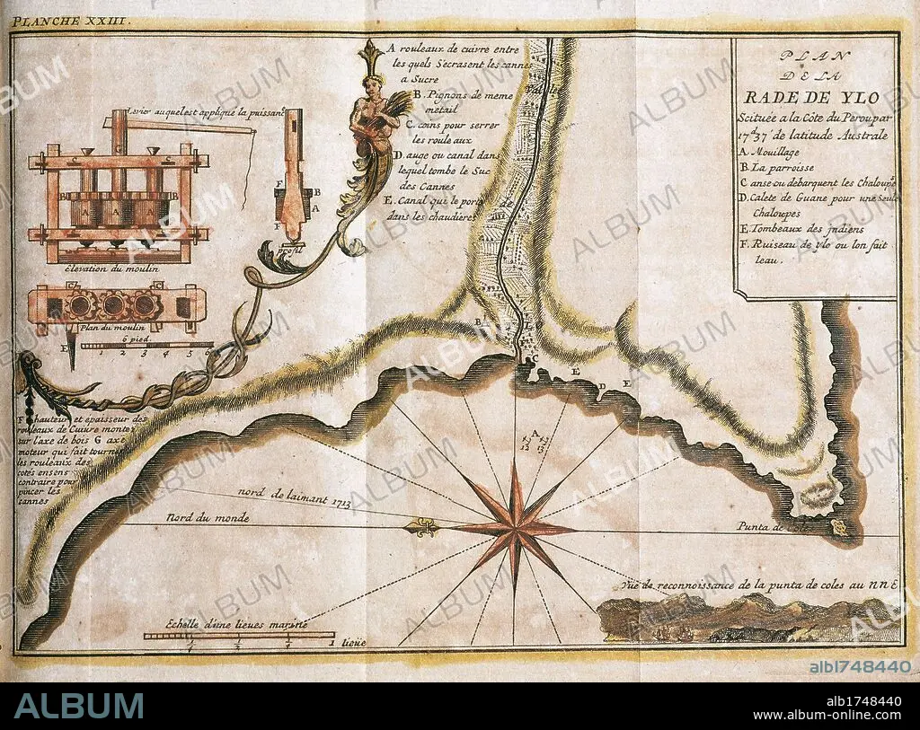
PERU. 18TH CENTURY. MAP OF THE RADA DE YLO (currently ILO), main port located on the Peruvian coast.
 Pinterest
 Twitter
 Facebook
 Copy link
 Email
Email


Title:
PERU. 18TH CENTURY. MAP OF THE RADA DE YLO (currently ILO), main port located on the Peruvian coast.
Caption:
SOUTH AMERICA. PERU. 18TH CENTURY. MAP OF THE RADA DE YLO (currently ILO), main port located on the Peruvian coast. Plane of a sugar mill. "RADA DE YLO", at 17.37 southern latitude, on the Pacific coast. French engraving of 1716. Library of Catalonia. Barcelona.
Credit:
Album / Kurwenal / Prisma
Releases:
Model: No - Property: No
Rights questions?
Rights questions?
Image size:
6201 x 4603 px | 81.7 MB
Print size:
52.5 x 39.0 cm | 20.7 x 15.3 in (300 dpi)
Keywords:
18TH CENTURY • 18TH CENTURY, THE • 18TH • ANCIENT CARTOGRAPHY • CARTOGRAPHY • COAST • COASTAL • COASTLINE • COMPASS ROSE • COMPASS • HISTORY OF ECONOMY • LATIN AMERICA • LATIN AMERICAN • LATINOAMERICA • MAP MAKING • MAP • MAPS • MARITIME • MILL • OCEAN, PACIFIC • PACIFIC OCEAN • PERU • PERUVIAN • PLAN (CARTOGRAPHY) • PLAN • PLANE • ROAD (SHIP) • SEASHORE • SEASIDE • SHORELINE • SOUTH AMERICA • SUDAMERICA • SUGAR CANE • SUGARCANE • TRADE HISTORY • WINDMILL • WINDROSE
