alb5465448
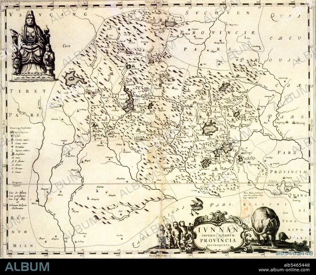
A Latin-based map of Yunnan Province dated 1644 CE.
| Share |
|---|
 Pinterest Pinterest |
 Twitter Twitter |
 Facebook Facebook |
 Copy link Copy link |
 Email Email |
|
Add to another lightbox |
|
Add to another lightbox |


Title:
A Latin-based map of Yunnan Province dated 1644 CE.
Caption:
Yunnan became part of the Han Dynasty (206 BC-220 CE) during the 2nd century BC. It became the seat of a Tibeto-Burman speaking kingdom known as Nanzhao in the 8th century. Nanzhao was multi-ethnic, but the elite most likely spoke a northern dialect of Yi, which became established as the prestige dialect. The Mongols conquered the region in the 13th century, with local control exercised by warlords until the 1930s. As with other parts of China's southwest, Japanese occupation in the north during World War II forced a migration of Chinese into the region. Ethnic minorities in Yunnan account for about 34 percent of its total population. Major ethnic groups include Yi, Bai, Hani, Zhuang, Dai and Miao.
Credit:
Album / Pictures From History/Universal Images Group
Releases:
Model: No - Property: No
Rights questions?
Rights questions?
Image size:
4644 x 3800 px | 50.5 MB
Print size:
39.3 x 32.2 cm | 15.5 x 12.7 in (300 dpi)
Keywords:
ASIA • ASIAN • CARTOGRAPHY • CHINA • CHINE • CHINESE • GUIZHOU • HISTORIA UNIVERSAL • HISTORIA • HISTORICAL • HISTORY • KUNMING • MAP MAKING • MAP • MAPS • MEKONG • MINORITIES • MINORITY GROUP • MINORITY GROUPS • PLAN (CARTOGRAPHY) • PORCELAIN • TIBET • TIBETAN • YUNNAN • YUNNANESE
