alb3345881
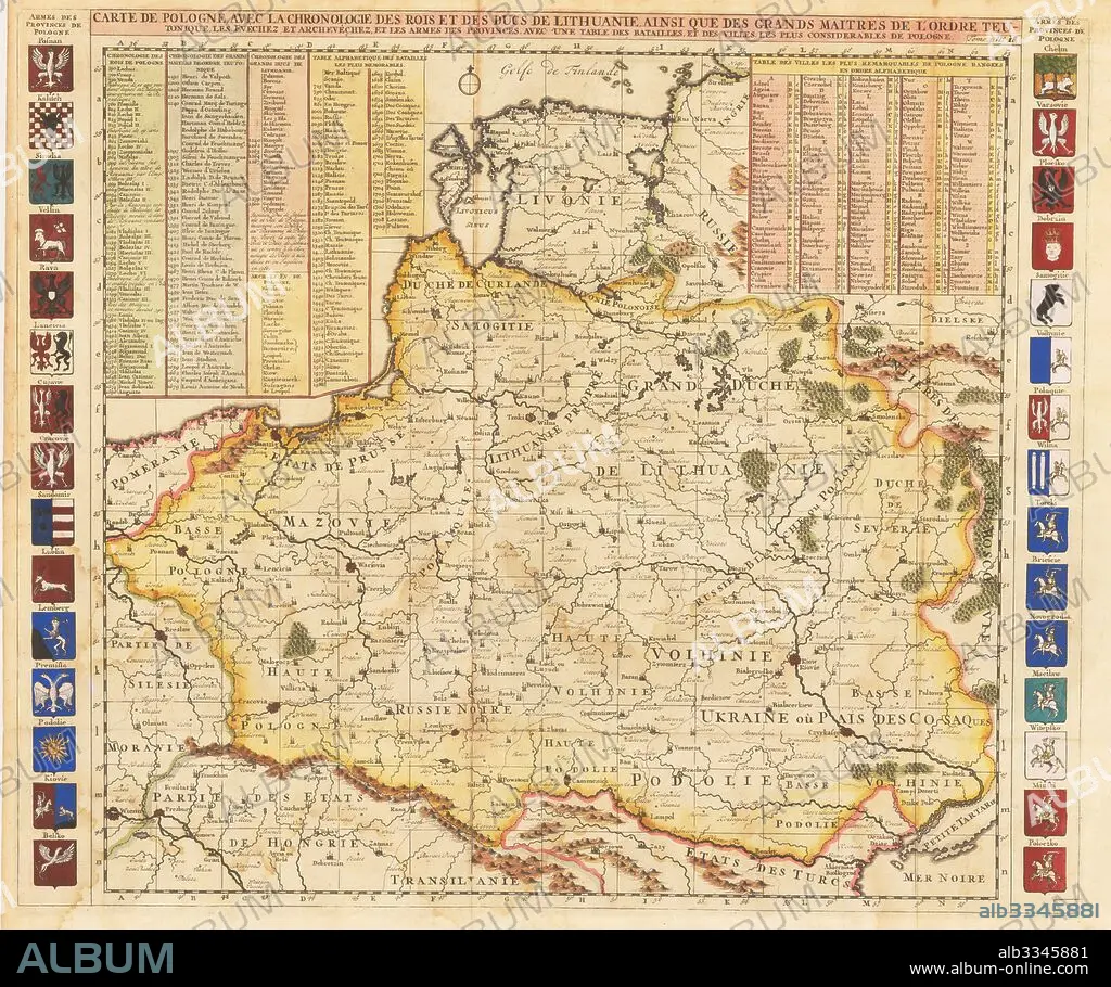
HENRI ABRAHAM CHATELAIN. Map of Poland includes portions of Livonia and Grand Duchy of Moscow.
| Share |
|---|
 Pinterest Pinterest |
 Twitter Twitter |
 Facebook Facebook |
 Copy link Copy link |
 Email Email |
|
Add to another lightbox |
|
Add to another lightbox |


Buy this image.
Select the use:

Caption:
Map of Poland includes portions of Livonia and Grand Duchy of Moscow
Technique/material:
Etching, watercolour
Museum:
PRIVATE COLLECTION
Credit:
Album / Fine Art Images
Releases:
Model: No - Property: No
Rights questions?
Rights questions?
Image size:
5400 x 4517 px | 69.8 MB
Print size:
45.7 x 38.2 cm | 18.0 x 15.1 in (300 dpi)
Keywords:
CARTOGRAPHY • CHATELAIN, HENRI ABRAHAM • COURLAND • EARLY RUS • ETCHING, WATERCOLOUR • FRANCE • GRAND DUCHY OF MOSCOW • GRAPHIC ARTS • HISTORY OF RUSSIA • HISTORY • LIVONIA • MAP MAKING • MAP • MOSCOW PRINCIPALITY • MUSCOVY • PETER I • POLAND • PRIVATE COLLECTION • RUSIA • RUSSIA • RUSSIAN HISTORY
