alb5413862
Joan Blaeu, Aragon Map, 17th Century
| Share |
|---|
 Pinterest Pinterest |
 Twitter Twitter |
 Facebook Facebook |
 Copy link Copy link |
 Email Email |
|
Add to another lightbox |
|
Add to another lightbox |


Title:
Joan Blaeu, Aragon Map, 17th Century
Caption:
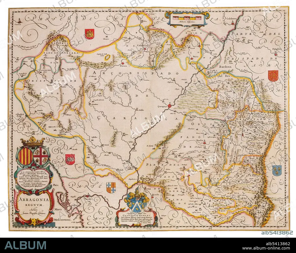
Aragon is an autonomous community in Spain, coextensive with the medieval Kingdom of Aragon. Located in northeastern Spain, the Aragonese autonomous community comprises three provinces (from north to south): Huesca, Zaragoza, and Teruel. Its capital is Zaragoza (Saragossa in English). Joan Blaeu (1596-1673) was a Dutch cartographer, the son of cartographer Willem Blaeu. In 1635 they published the Atlas Novus (full title: Theatrum orbis terrarum, sive, Atlas novus) in two volumes. The Atlas Maior is the final version of Joan Blaeu's atlas, published in Amsterdam between 1662 and 1672, in Latin, French, Dutch, German and Spanish, containing 594 maps and around 3,000 pages of text. The Blaeu maps emphasized fine art and colours, being the most expensive of the time. The Atlas Maior is widely considered a masterpiece of the Golden Age of Dutch/Netherlandish cartography.
Credit:
Album / Science Source
Releases:
Model: No - Property: No
Rights questions?
Rights questions?
Image size:
4200 x 3373 px | 40.5 MB
Print size:
35.6 x 28.6 cm | 14.0 x 11.2 in (300 dpi)
Keywords:
1600S • 17TH CENTURY • 17TH • AGE • ÂGÉS • ARAGON • ATLAS • AUTONOMOUS • BLAEU • CARTOGRAPHIC • CARTOGRAPHICAL • CARTOGRAPHY • CELEBRITY • CENTURY • COMMUNITY • DUTCH / NETHERLANDISH • DUTCH • FAMOUS • GEOGRAPHIC • GEOGRAPHICAL • GEOGRAPHY • GOLDEN • HISTORIC • HISTORICAL • HISTORY • IMPORTANT • INFLUENTIAL • JOAN • MAKING • MAP MAKING • MAP • MAP-MAKING • MAPMAKING • NOTABLE • NOVUS • OF • OLD • SEVENTEETH • SPAIN • WELL-KNOWN
