alb9356864
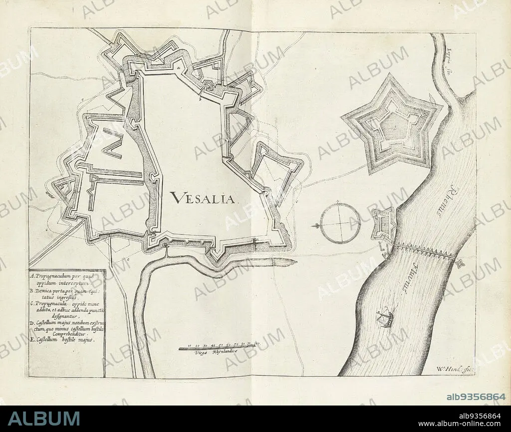
Map of Wesel, 1629, Vesalia (title on object), Map of the city of Wesel, taken by the State army under Frederick Henry, August 19, 1629., print maker: Willem Hondius (mentioned on object), Northern Netherlands, 1629 - 1631, paper, engraving, height 236 mm × width 305 mm.
| Share |
|---|
 Pinterest Pinterest |
 Twitter Twitter |
 Facebook Facebook |
 Copy link Copy link |
 Email Email |
|
Add to another lightbox |
|
Add to another lightbox |


Caption:
Map of Wesel, 1629, Vesalia (title on object), Map of the city of Wesel, taken by the State army under Frederick Henry, August 19, 1629., print maker: Willem Hondius (mentioned on object), Northern Netherlands, 1629 - 1631, paper, engraving, height 236 mm × width 305 mm
Credit:
Album / quintlox
Releases:
Model: No - Property: No
Rights questions?
Rights questions?
Image size:
4419 x 3502 px | 44.3 MB
Print size:
37.4 x 29.7 cm | 14.7 x 11.7 in (300 dpi)
Keywords:
1629 • 1631 • AUGUST 19 • CITY • ENGRAVED • ENGRAVING (ARTWORK) • ENGRAVING • ENGRAVING. • ENGRAVINGS • ETCHING • HEIGHT 236 MM • MAP • MAPS • MENTIONED • NORTHERN NETHERLANDS • PAPER AND PACKAGE PRODUCTS • PAPER • PLAN (CARTOGRAPHY) • PRINT MAKER • PRINT • STATE ARMY UNDER FREDERICK HENRY • TOWN • TOWNS • VESALIA • WESEL • WIDTH 305 MM • WILLEM HONDIUS
