alb3793218
Tropical Cyclone Gonu, 2007
| Share |
|---|
 Pinterest Pinterest |
 Twitter Twitter |
 Facebook Facebook |
 Copy link Copy link |
 Email Email |
|
Add to another lightbox |
|
Add to another lightbox |


Title:
Tropical Cyclone Gonu, 2007
Caption:
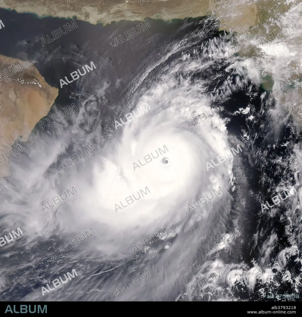
On June 4, 2007, when the Moderate Resolution Imaging Spectroradiometer (MODIS) on NASA's Aqua satellite captured this image, Tropical Cyclone Gonu was approaching the northeastern shore of Oman, a region better known for hot desert conditions. Though rare, cyclones like Gonu are not unheard of in the northern Indian Ocean basin. Most cyclones that form in the region form over the Bay of Bengal, east of India. Those that take shape over the Arabian Sea, west of the Indian peninsula, tend to be small and fizzle out before coming ashore. Cyclone Gonu is a rare exception. As of June 4, 2007, the powerful storm had reached a dangerous Category Four status, and it was forecast to graze Oman's north-eastern shore, following the Gulf of Oman. MODIS acquired this photo-like image at 12:00 p.m. local time (9:00 UTC), a few hours after the Joint Typhoon Warning Center estimated Gonu's sustained winds to be over 240 kilometers per hour (145 miles per hour). The satellite image confirms that Gonu was a super-powerful cyclone.
Credit:
Album / NASA/Science Source
Releases:
Model: No - Property: No
Rights questions?
Rights questions?
Image size:
5400 x 5400 px | 83.4 MB
Print size:
45.7 x 45.7 cm | 18.0 x 18.0 in (300 dpi)
Keywords:
2000S • 21ST CENTURY • 21ST • 21TH CENTURY • AERIAL • AQUA SATELLITE • ARABIAN SEA • CATEGORY 4 • CYCLONE • GONU • GULF OF OMAN • HOT TOWERS. 2007 • INDIAN OCEAN • METEOROLOGY • METEOROLOGY • MODERATE RESOLUTION IMAGING SPECTRORADIOMETER • MODIS • OMAN • SATELLITE IMAGE • SATELLITE IMAGERY • SATELLITE-VIEW • SCIENCE • STORM • TROPICAL CYCLONE • WEATHER
