alb4632479
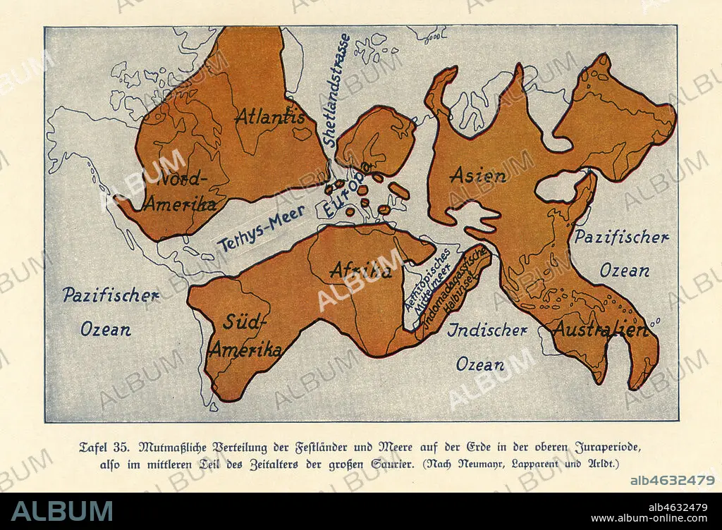
Map of the continents and seas in the Upper Jurassic era. Atlantis, North America, South America, Africa, Europe, Indonesian Peninsula, Asia and Australia. Tethys Ocean, Shetland Strait, Colour print after an illustration from Wilhelm Bolsches Das Leben der Urwelt, Prehistoric Life, Georg Dollheimer, Leipzig, 1932.
| Share |
|---|
 Pinterest Pinterest |
 Twitter Twitter |
 Facebook Facebook |
 Copy link Copy link |
 Email Email |
|
Add to another lightbox |
|
Add to another lightbox |


Caption:
Map of the continents and seas in the Upper Jurassic era. Atlantis, North America, South America, Africa, Europe, Indonesian Peninsula, Asia and Australia. Tethys Ocean, Shetland Strait, Colour print after an illustration from Wilhelm Bolsches Das Leben der Urwelt, Prehistoric Life, Georg Dollheimer, Leipzig, 1932.
Credit:
Album / Florilegius
Releases:
Model: No - Property: No
Rights questions?
Rights questions?
Image size:
6816 x 4655 px | 90.8 MB
Print size:
57.7 x 39.4 cm | 22.7 x 15.5 in (300 dpi)
Keywords:
ASIA • COLOUR PRINT • CONTINENTS • DAS LEBEN DER URWELT • DINOSAURS • EUROPA • EUROPE • EXTINCT • FLEET • ILLUSTRATION • ILLUSTRATIONS • INDONESIAN PENINSULA • MAP • MAPS • MARINE CREATURE • MARINE • NAVY • NORTH AMERICA • NORTH AMERICAN • OCEAN • PALAEONTOLOGY • PALEONTOLOGY • PLAN (CARTOGRAPHY) • PREHISTORIC LIFE • PREHISTORY • SEA • SEAS • SHETLAND STRAIT • SOUTH AMERICA • SUDAMERICA • TETHYS OCEAN • UPPER JURASSIC ATLANTIS • WILHELM BOLSCHE • ZOOLOGY
