alb3980258
Map of London, 1560. Artist: George Vertue
| Share |
|---|
 Pinterest Pinterest |
 Twitter Twitter |
 Facebook Facebook |
 Copy link Copy link |
 Email Email |
|
Add to another lightbox |
|
Add to another lightbox |


Buy this image.
Select the use:

Title: Map of London, 1560. Artist: George Vertue
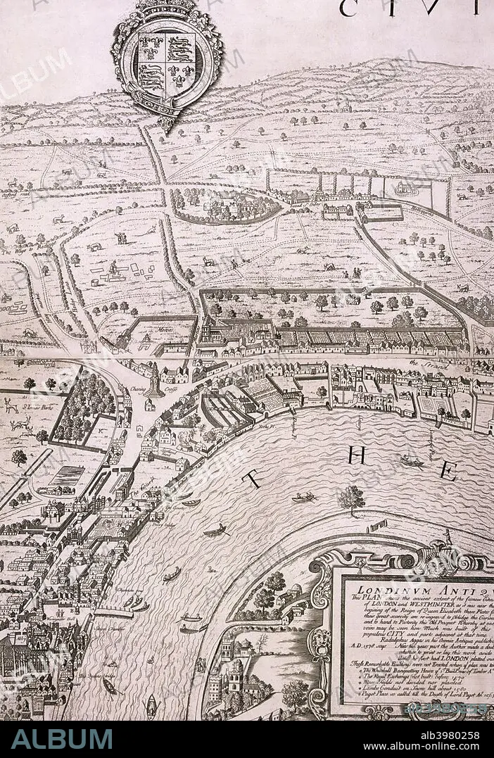
Caption: Map of London in the year 1560; showing the area between Westminster and the Strand, with Lambeth to the south of the River Thames and the Tudor royal arms at the top.
Personalities: GEORGE VERTUE
Credit: Album / The London Archives (City of London)/Heritage Images
Releases: ? Model Release: No - ? Property Release: No
Rights questions?
Rights questions?
Image size: 3461 × 5047 px | 50.0 MB
Print size: 29.3 × 42.7 cm | 1362.6 × 1987.0 in (300 dpi)
Keywords: 16 16TH XVI XVITH SIXTEENTH CENTURY • 16 CENTURY • 16TH CENTURY • 16TH • ANON; ANON; ANONYMOUS • B & W • B / W • B W • B&W • BLACK & WHITE • BLACK AND WHITE • CENTURY • CITY OF LONDON • CITY OF WESTMINSTER • COAT OF ARMS • ENGLAND • ENGRAVING • GEOGRAFIA • GEOGRAPHICAL FEATURE • GEOGRAPHY • GEORGE VERTUE • GEORGE • GUILDHALL LIBRARY & ART GALLERY • HERALDRY • LAMBETH • LONDON • MAP • MONOCHROMATIC • MONOCHROME • PEOPLE • RIVER THAMES • RIVER • ROYAL • ROYALTY • SIXTEENTH CENTURY • THAMES RIVER • THAMES • TUDOR • VERTUE • WESTMINSTER • XVI CENTURY
