alb3548663
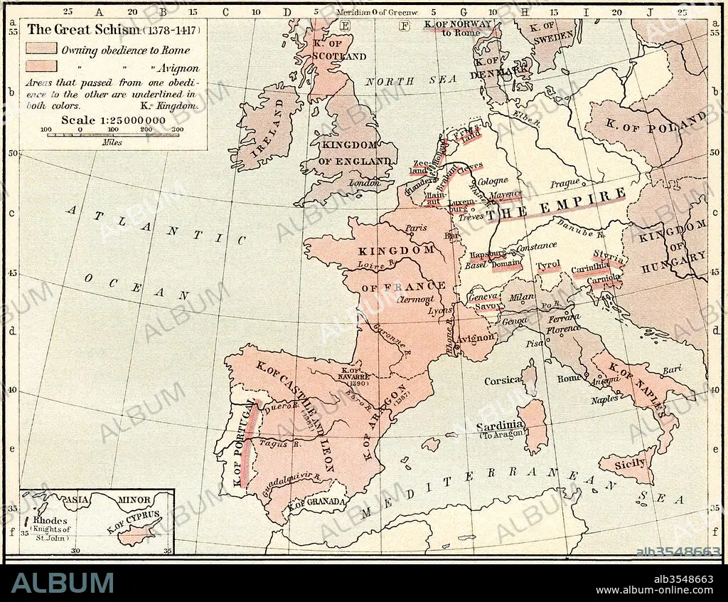
Map of The Western Schism, or Papal or Great Schism, 1378-1417, showing allegiance of European countries
| Share |
|---|
 Pinterest Pinterest |
 Twitter Twitter |
 Facebook Facebook |
 Copy link Copy link |
 Email Email |
|
Add to another lightbox |
|
Add to another lightbox |


Buy this image.
Select the use:

Title:
Map of The Western Schism, or Papal or Great Schism, 1378-1417, showing allegiance of European countries
Caption:
Map of The Western Schism, or Papal or Great Schism, 1378 - 1417, showing allegiance of European countries. From Historical Atlas, published 1923.
Credit:
Album / Universal Images Group / Universal History Archive
Releases:
Model: No - Property: No
Rights questions?
Rights questions?
Image size:
4883 x 3783 px | 52.8 MB
Print size:
41.3 x 32.0 cm | 16.3 x 12.6 in (300 dpi)
Keywords:
1378 • 1378-1417 • 1417 • 14TH CENTURY • 14TH • 15 15TH XV XVTH FIFTEENTH CENTURY • 15TH CENTURY • 15TH CENTURY; • 15TH • ALLEGIANCE • CATHOLIC • CATHOLICISM • CENTURY • CHART • CHURCH • CHURCHES • COUNTRIES • COUNTRY • ECCLESIA • EUROPEA • EUROPEAN • EUROPEANS • FIFTEENTH CENTURY • FIFTEENTH • FOURTEENTH CENTURY • FOURTEENTH • GEOGRAFIA • GEOGRAPHICAL • GEOGRAPHY • GREAT • HISTORIA UNIVERSAL • HISTORIA • HISTORICAL • HISTORY • HISTORY. • MAP • MAPS • PAPAL • PLAN (CARTOGRAPHY) • SCHISM • SIGLO XV • WESTERN • XIV CENTURY • XV CENTURY
