alb9387288
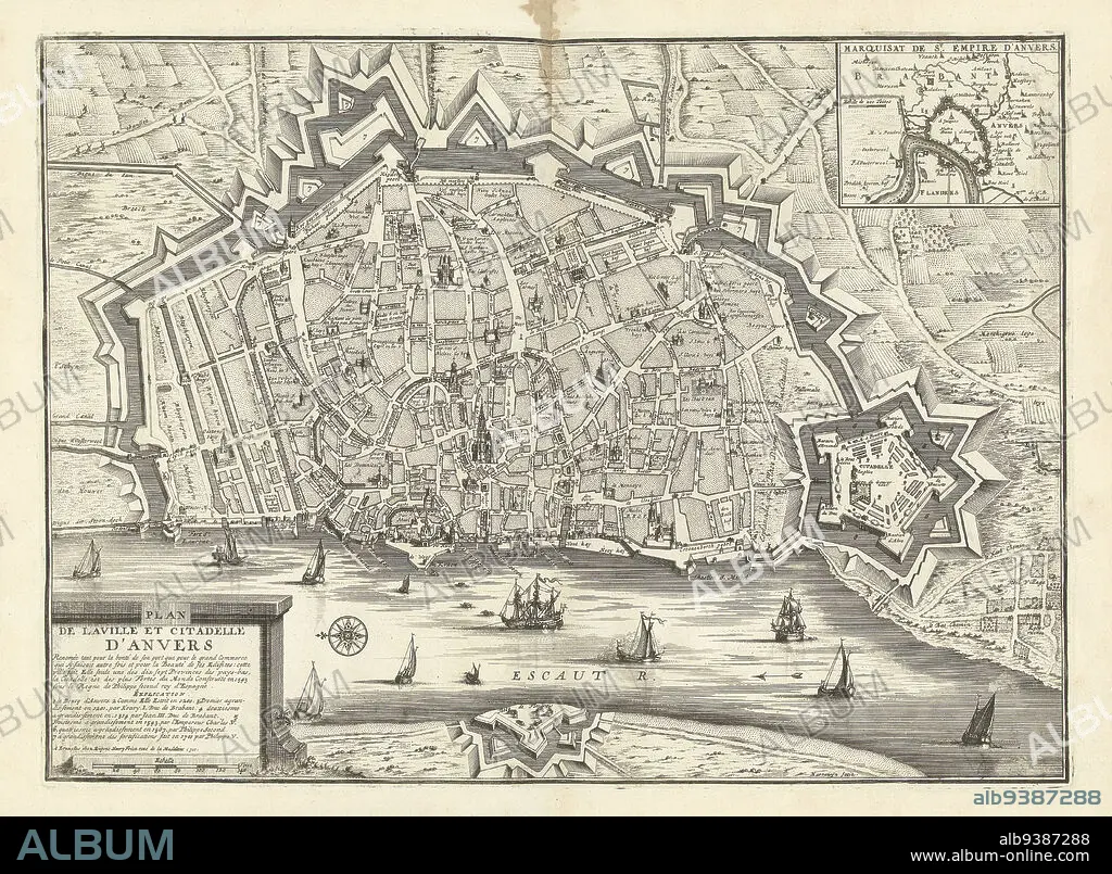
Map of Antwerp, 1711, Plan de la ville et citadelle d'Anvers (title on object), Map of Antwerp, 1711. Top right an inset with a map of the larger area. Part of a bundled collection of plans of battles and cities famous in the War of the Spanish Succession., print maker: Jacobus Harrewijn (mentioned on object), publisher: Eugene Henry Fricx (mentioned on object), Brussels, 1711, paper, etching, height 395 mm × width 535 mm.
| Share |
|---|
 Pinterest Pinterest |
 Twitter Twitter |
 Facebook Facebook |
 Copy link Copy link |
 Email Email |
|
Add to another lightbox |
|
Add to another lightbox |


Buy this image.
Select the use:

Caption:
Map of Antwerp, 1711, Plan de la ville et citadelle d'Anvers (title on object), Map of Antwerp, 1711. Top right an inset with a map of the larger area. Part of a bundled collection of plans of battles and cities famous in the War of the Spanish Succession., print maker: Jacobus Harrewijn (mentioned on object), publisher: Eugene Henry Fricx (mentioned on object), Brussels, 1711, paper, etching, height 395 mm × width 535 mm
Personalities:
Credit:
Album / quintlox
Releases:
Model: No - Property: No
Rights questions?
Rights questions?
Image size:
5508 x 4044 px | 63.7 MB
Print size:
46.6 x 34.2 cm | 18.4 x 13.5 in (300 dpi)
Keywords:
1711 • ANTWERP • BATTLES • BRUSSELS • BUNDLED COLLECTION • CITIES FAMOUS • CITY OF BRUSSELS • ETCHING • EUGENE HENRY FRICX • HEIGHT 395 MM • HUNDRED YEARS WAR • INSET • JACOBUS HARREWIJN • LARGER AREA • MAP • MAPS • MENTIONED • PAPER AND PACKAGE PRODUCTS • PAPER • PART • PLAN (CARTOGRAPHY) • PLAN DE LA VILLE ET CITADELLE D'ANVERS • PLANS • PRINT MAKER • PUBLISHER • SPANISH SUCCESSION • TOP RIGHT • WAR • WARFARE • WARS • WIDTH 535 MM
