alb2603218
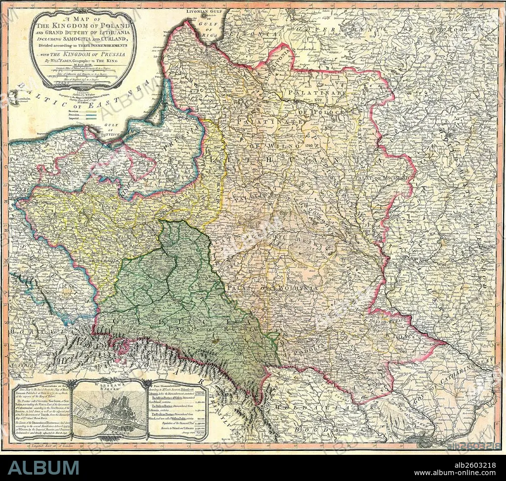
Map showing the partition of the Kingdom of Poland and the Grand Duchy of Lithuania.
| Share |
|---|
 Pinterest Pinterest |
 Twitter Twitter |
 Facebook Facebook |
 Copy link Copy link |
 Email Email |
|
Add to another lightbox |
|
Add to another lightbox |


Title:
Map showing the partition of the Kingdom of Poland and the Grand Duchy of Lithuania.
Caption:
Map showing the partition of the Kingdom of Poland and the Grand Duchy of Lithuania, 1799.
Credit:
Album / Universal Images Group / Universal History Archive
Releases:
Model: No - Property: No
Rights questions?
Rights questions?
Image size:
4827 x 4344 px | 60.0 MB
Print size:
40.9 x 36.8 cm | 16.1 x 14.5 in (300 dpi)
Keywords:
1790S • 18TH CENTURY • 18TH CENTURY, THE • 18TH • COMMUNISM: POLAND • LITHUANIA • MAP • MAPS • PARTITION • PLAN (CARTOGRAPHY) • POLAND • POLAND: COMMUNISM • POLAND: POSTWAR • POSTWAR: POLAND • RUSIA • RUSSIA
