alb3285632
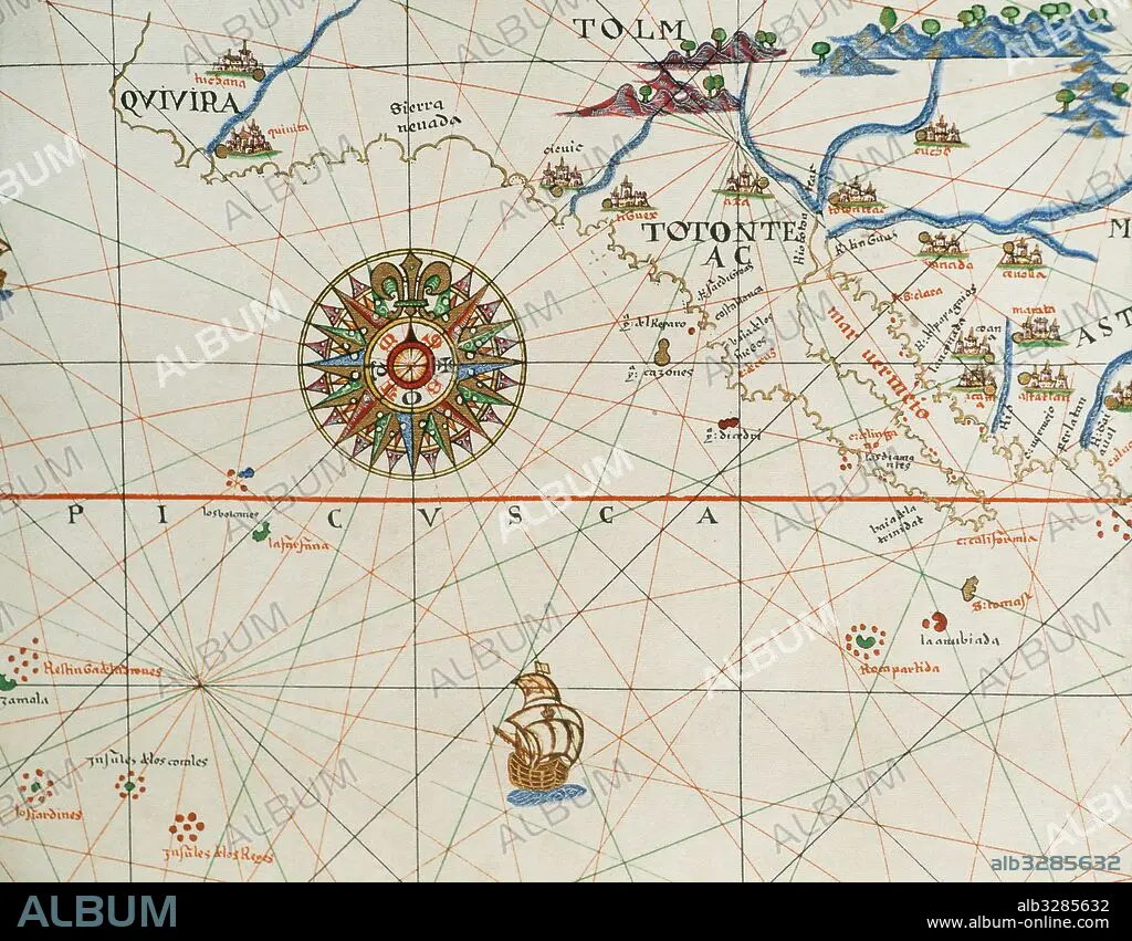
Coast of high and low california and compass rose. Nautical chart. Atlas of Joan Martines, 1587. Dedicated to Philip II. Mallorcan School.
| Share |
|---|
 Pinterest Pinterest |
 Twitter Twitter |
 Facebook Facebook |
 Copy link Copy link |
 Email Email |
|
Add to another lightbox |
|
Add to another lightbox |


Buy this image.
Select the use:

Caption: Coast of high and low california and compass rose. Nautical chart. Atlas of Joan Martines, 1587. Dedicated to Philip II. Mallorcan School.
Credit: Album / Prisma
Releases: ? Model Release: No - ? Property Release: No
Rights questions?
Rights questions?
Image size: 5079 × 3957 px | 57.5 MB
Print size: 43.0 × 33.5 cm | 1999.6 × 1557.9 in (300 dpi)
Keywords: 1587 • 16 16TH XVI XVITH SIXTEENTH CENTURY • 16 CENTURY • 16TH CENTURY • 16TH • AMERICA • AMERICA. • AMERICAS • AMERICAS, THE • ANCIENT CARTOGRAPHY • ART • ARTS • ATLANTE • ATLANTEAN • ATLAS • BAJA CALIFORNIA • CALIFORNIA • CARDINAL DIRECTIONS • CARTOGRAPHY • COAST • COASTAL • COASTLINE • COMPASS ROSE • COMPASS • COSMOGRAPHER • EUROPA • EUROPE • FLEET • HISTORIA UNIVERSAL • HISTORIA • HISTORIC • HISTORICAL • HISTORY • HISTORY. • JOAN MARTINES • LEGEND • MAP MAKING • MAP • MAPPING • MAPS • MARINE • MARÍTIMA • MARITIME NAVIGATION • MARITIME • MARTINES • MESSINA • MEXICO • MODERN AGE • MODERN ERA • MODERN PERIOD • NAUTICAL CHART • NAUTICAL • NAVEGATION • NAVIGATION • NAVY • OCEAN • OCEANS • OLD MAP • PLAN (CARTOGRAPHY) • PORTOLANO • PORTULAN • ROSE OF THE WINDS • SAILING • SEA CHART • SEA • SEA. • SEAMANSHIP • SEAS • SEASHORE • SEASIDE • SHIPPING • SHORELINE • SPAIN • SPANISH • WINDROSE • XVI CENTURY
