alb4181811
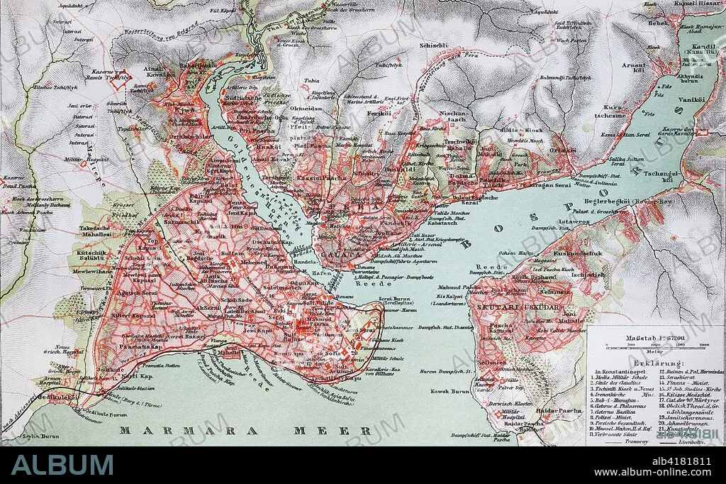
city map from the year 1892
| Share |
|---|
 Pinterest Pinterest |
 Twitter Twitter |
 Facebook Facebook |
 Copy link Copy link |
 Email Email |
|
Add to another lightbox |
|
Add to another lightbox |


Buy this image.
Select the use:

Title:
city map from the year 1892
Caption:
city map from the year 1892: Konstantinopel, Constantinople, now Istanbul, Turkey, digital improved reproduction of an original print from the year 1895
Credit:
Album / Universal Images Group / Bildagentur/UIG
Releases:
Model: No - Property: No
Rights questions?
Rights questions?
Image size:
4048 x 2488 px | 28.8 MB
Print size:
34.3 x 21.1 cm | 13.5 x 8.3 in (300 dpi)
