alb1962544
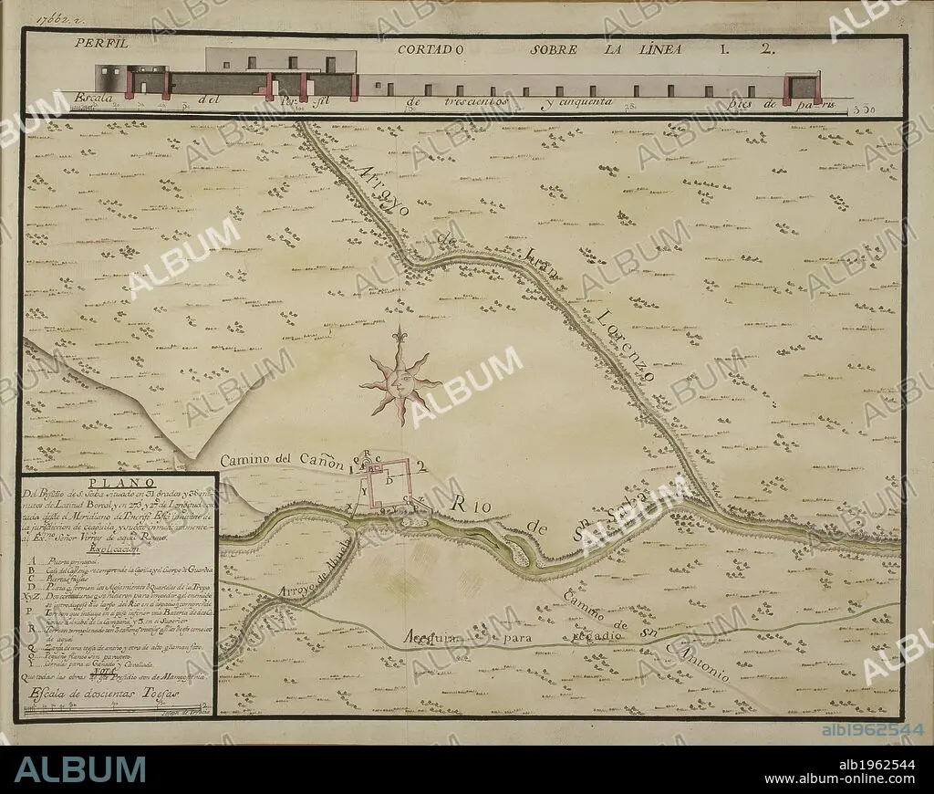
Plano del presidio de S. Saba situado en 31 grados y 38 minutos de latitud boreal y en 273° y 27' de longitud contada desde el meridiano de Tenerife esta inhivido de la jurisdiccion de coaguila, y suheto inmediatamente al emo. señor virrey de aquel reyno. TWENTY-ONE coloured maps and plans of towns and various settlements in the North of Mexico with their environs; all, except one, situated in the Provincias Internas. By Joseph de Urrutia. Paper, XVIIIth cent. Folio. Ca. 1768. Source: Add. 17662 r18.
| Share |
|---|
 Pinterest Pinterest |
 Twitter Twitter |
 Facebook Facebook |
 Copy link Copy link |
 Email Email |
|
Add to another lightbox |
|
Add to another lightbox |


Author:
Caption:
Plano del presidio de S. Saba situado en 31 grados y 38 minutos de latitud boreal y en 273° y 27' de longitud contada desde el meridiano de Tenerife esta inhivido de la jurisdiccion de coaguila, y suheto inmediatamente al emo. señor virrey de aquel reyno. TWENTY-ONE coloured maps and plans of towns and various settlements in the North of Mexico with their environs; all, except one, situated in the Provincias Internas. By Joseph de Urrutia. Paper, XVIIIth cent. Folio. Ca. 1768. Source: Add. 17662 r18.
Credit:
Album / British Library
Releases:
Model: No - Property: No
Rights questions?
Rights questions?
Image size:
6354 x 5068 px | 92.1 MB
Print size:
53.8 x 42.9 cm | 21.2 x 16.9 in (300 dpi)
Keywords:
18TH CENTURY • 18TH CENTURY, THE • 18TH • CARTE • CARTOGRAPHIC • CARTOGRAPHY • DE URRUTIA, JOSEPH • EEUU • MAP MAKING • MAP • MAPS • MEXICO • NEW MEXICO • NORTH AMERICA • NORTH AMERICAN • PLAN (CARTOGRAPHY) • U. S. A • UNITED STATES • US STATES • XVIII CENTURY
