alb3799799
Medieval World Map
| Share |
|---|
 Pinterest Pinterest |
 Twitter Twitter |
 Facebook Facebook |
 Copy link Copy link |
 Email Email |
|
Add to another lightbox |
|
Add to another lightbox |


Title:
Medieval World Map
Caption:
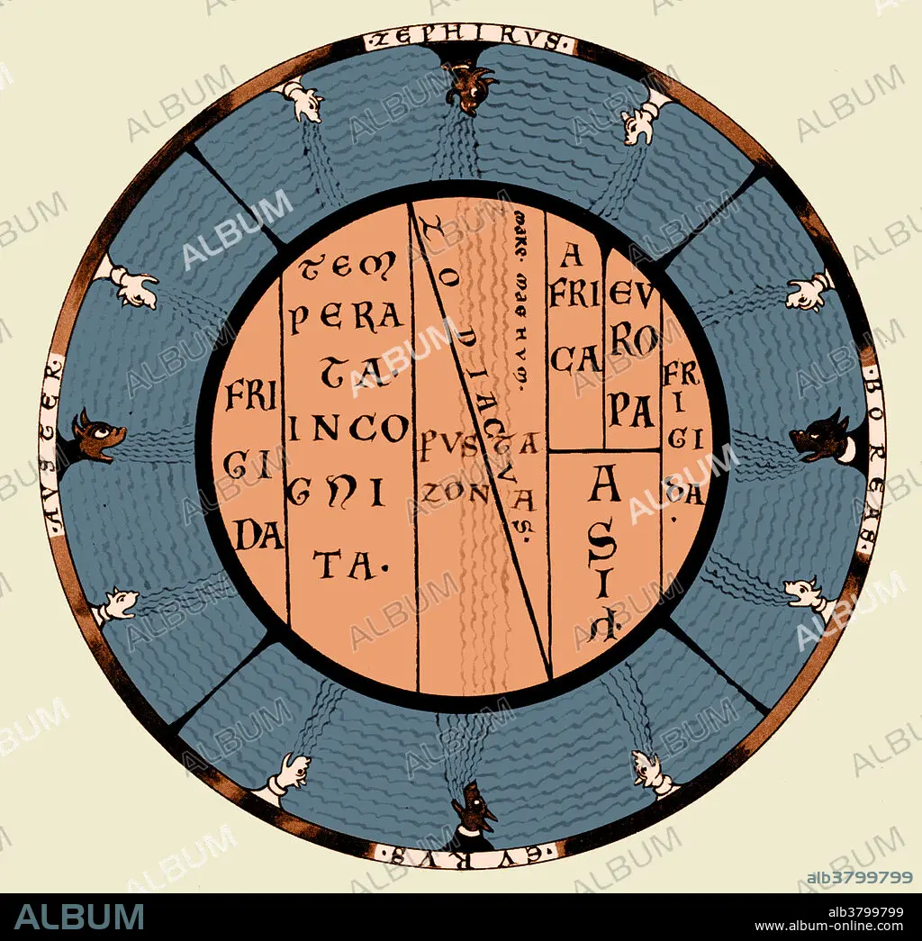
T and O (orbis terrarum) map of the Medieval world by Macrobius Ambrosius, showing the climatic zones and the Mare Magnum, the Great Ocean which was thought to separate the inhabited world from an unknown continent in the south.
Credit:
Album / Science Source
Releases:
Model: No - Property: No
Rights questions?
Rights questions?
Image size:
4200 x 4068 px | 48.9 MB
Print size:
35.6 x 34.4 cm | 14.0 x 13.6 in (300 dpi)
Keywords:
ÂGÉS • AMBROSIUS • AND • ANTIQUE • ART • ARTWORK • BEATINE • BEATUS • CARTOGRAPHY • DRAWING • ENGRAVING • HISTORICAL • HISTORY • ILLUSTRATION • ILLUSTRATIONS • MACROBIUS • MAP MAKING • MAP • MEDIEVAL • MIDDLE • O • O-T • ORBIS • PRINT • T • T-O • TERRARUM • THEODOSIUS
