alb3298411
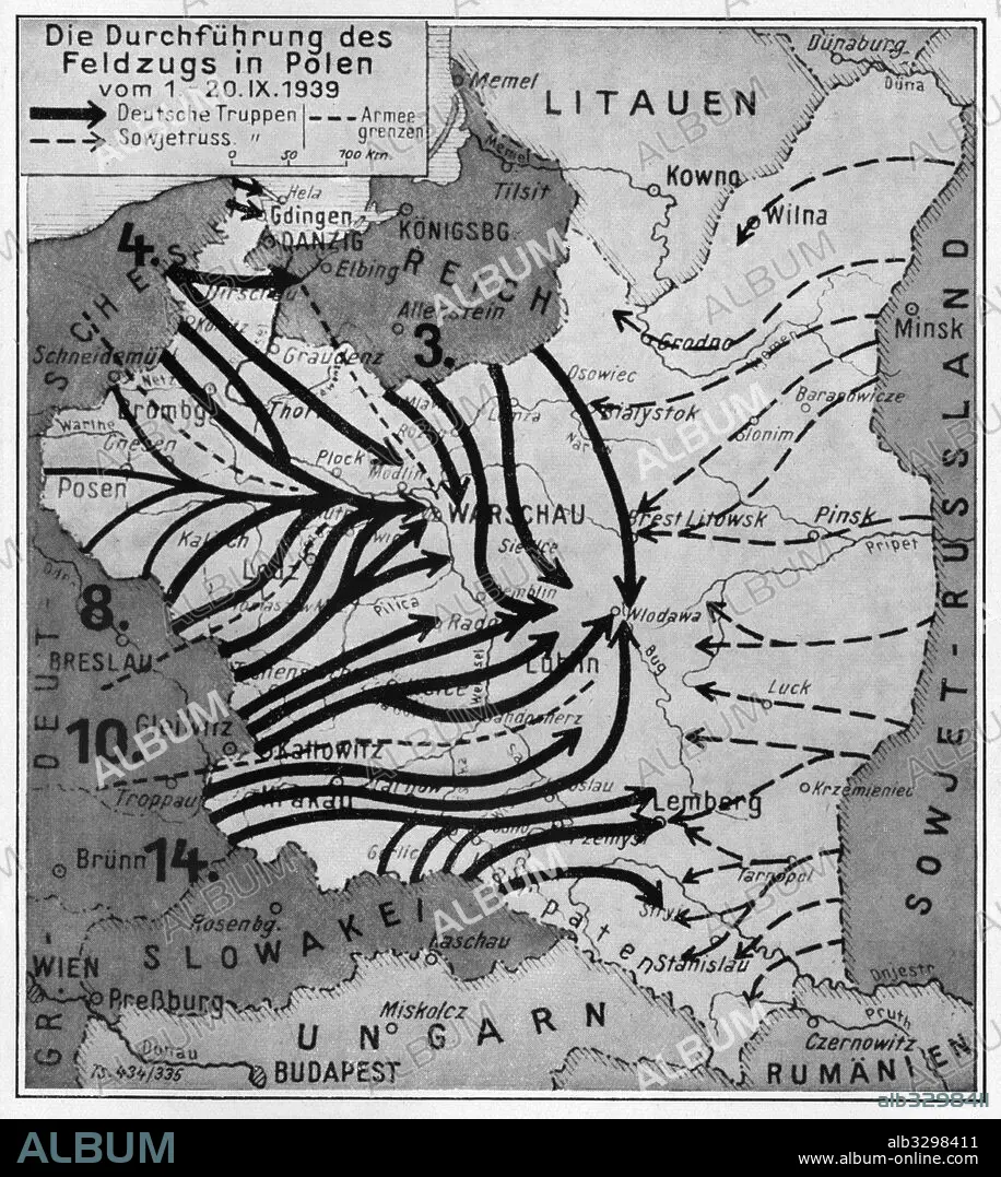
A map showing the execution of the German Campaign in Poland from the 1st to the 20th of September 1939.
| Share |
|---|
 Pinterest Pinterest |
 Twitter Twitter |
 Facebook Facebook |
 Copy link Copy link |
 Email Email |
|
Add to another lightbox |
|
Add to another lightbox |


Buy this image.
Select the use:

Caption:
A map showing the execution of the German Campaign in Poland from the 1st to the 20th of September 1939
Credit:
Album / Universal Images Group / Past Pix / Science & Society Picture Library
Releases:
Model: No - Property: No
Rights questions?
Rights questions?
Image size:
3525 x 3941 px | 39.7 MB
Print size:
29.8 x 33.4 cm | 11.8 x 13.1 in (300 dpi)
Keywords:
1939 • ADVANCE • ARMED FORCES • ASSAULT • ATTACK • ATTACKING • BLACK AND WHITE IMAGE • CAMPAIGN • COMMUNISM: POLAND • DEPLOYMENT • DIRECTIONAL ARROW • EASTERN FRONT • ENCROACHMENT • GEOGRAFIA • GEOGRAPHY • GERMAN • GERMANS • GUERRA • HUNDRED YEARS WAR • INVASION • INVASION • MAP • MAPS • NO ONE • NO-ONE • NOBODY • OCCUPIED TERRITORIES • OCCUPIED TERRITORY • OPERATION • PASTPIX • PLAN (CARTOGRAPHY) • PLAN • POLAND • POLAND: COMMUNISM • POLAND: POSTWAR • POSTWAR: POLAND • STRATEGY • SURGERY • THIRD REICH • THIRD_REICH • VERTICAL IMAGE • WAR • WARFARE • WARS • WEHRMACHT • WORLD WAR 2 • WORLD WAR II • WORLD WAR TWO • WW II • WWII
