alb3545996
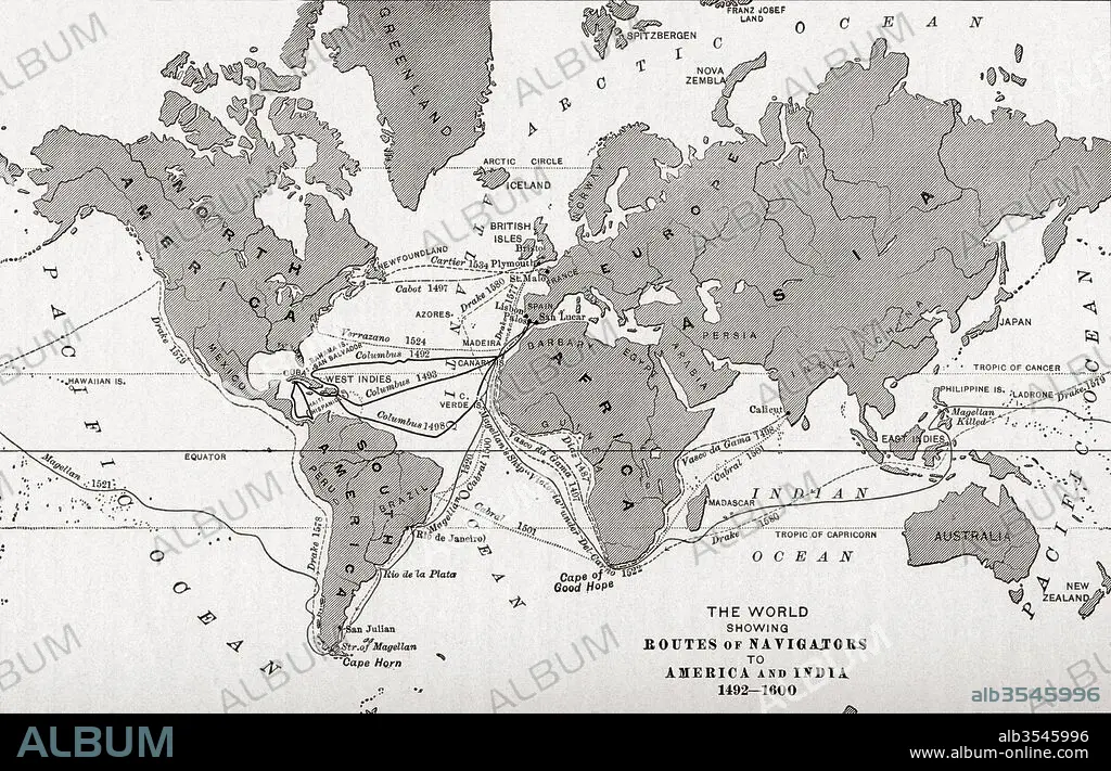
Map of the world showing the routes of navigators to America and India from 1492-1600
| Share |
|---|
 Pinterest Pinterest |
 Twitter Twitter |
 Facebook Facebook |
 Copy link Copy link |
 Email Email |
|
Add to another lightbox |
|
Add to another lightbox |


Buy this image.
Select the use:

Title:
Map of the world showing the routes of navigators to America and India from 1492-1600
Caption:
Map of the world showing the routes of navigators to America and India from 1492-1600. From The History of Our Country, published 1899
Credit:
Album / Universal Images Group / Universal History Archive
Releases:
Image size:
5220 x 3355 px | 50.1 MB
Print size:
44.2 x 28.4 cm | 17.4 x 11.2 in (300 dpi)
Keywords:
1492-1600 • 15 15TH XV XVTH FIFTEENTH CENTURY • 15TH CENTURY • 15TH CENTURY; • 15TH • 16 16TH XVI XVITH SIXTEENTH CENTURY • 16 CENTURY • 16TH CENTURY • 16TH • AMERICA • AMERICA. • AMERICAN • AMERICANS • AMERICAS • AMERICAS, THE • CENTURY • CHART • COUNTRIES • COUNTRY • DISCOVERY • EEUU • EXPLORATION • FIFTEENTH CENTURY • FIFTEENTH • GEOGRAFIA • GEOGRAPHICAL • GEOGRAPHY • INDIA • MAP • MAPS • NAVIGATION • NAVIGATORS • PLAN (CARTOGRAPHY) • ROUTE • ROUTES • SIGLO XV • SIXTEENTH • STATES • TRACK • U S A • U. S. A • U. S. A. • U. S. • UNITED STATES AMERICA • UNITED STATES OF AMERICA • UNITED STATES • UNITED • US • USA • USA. UNITED STATES • WORLD • XV CENTURY • XVI CENTURY
