alb4057482
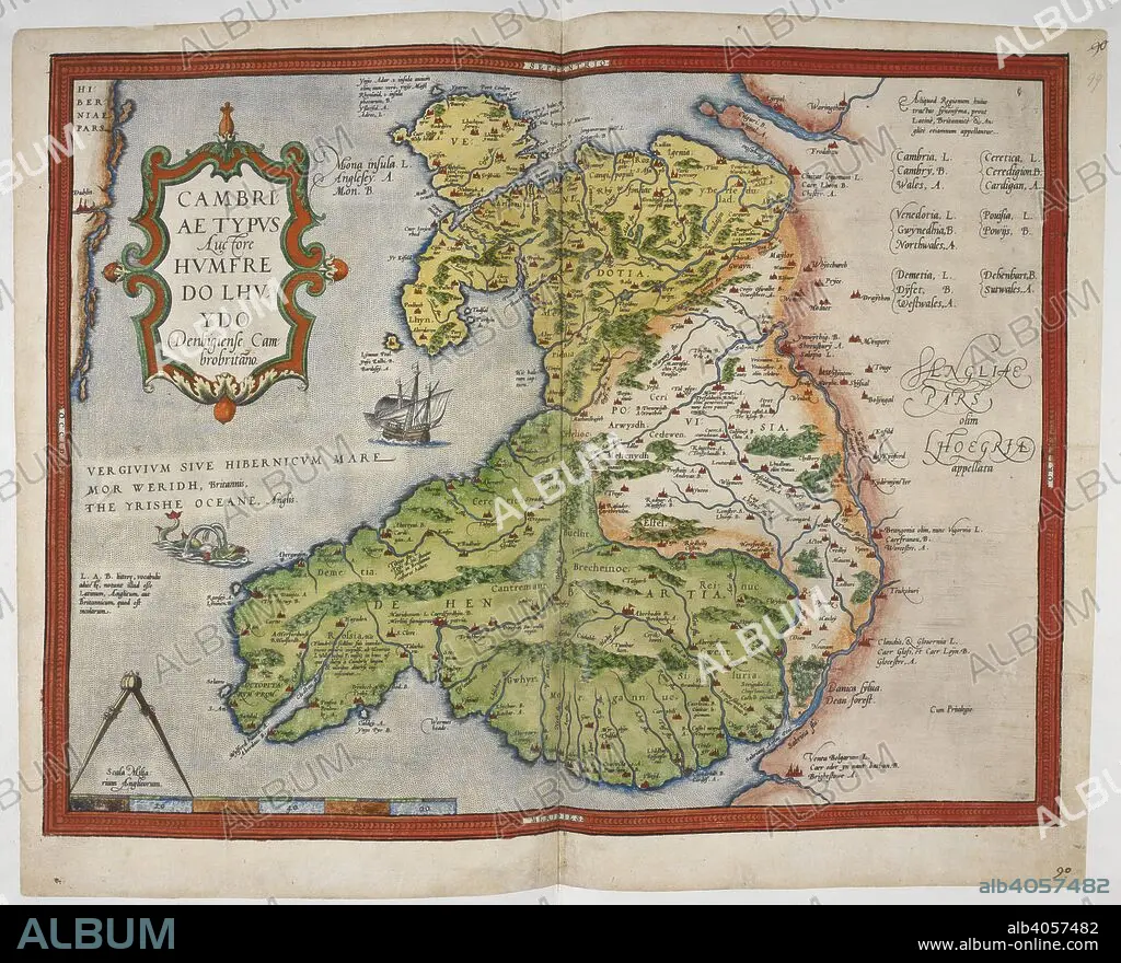
CHRISTOPHER SAXTON and HUMPHREY LLOYD. Coloured printed map of Wales and Anglesey. Lord Burghley's Atlas. London; 1579. Source: Royal 18 D. III, ff.98v-99. Language: English.
| Share |
|---|
 Pinterest Pinterest |
 Twitter Twitter |
 Facebook Facebook |
 Copy link Copy link |
 Email Email |
|
Add to another lightbox |
|
Add to another lightbox |


Buy this image.
Select the use:

Caption:
Coloured printed map of Wales and Anglesey. Lord Burghley's Atlas. London; 1579. Source: Royal 18 D. III, ff.98v-99. Language: English.
Credit:
Album / British Library
Releases:
Image size:
6223 x 5025 px | 89.5 MB
Print size:
52.7 x 42.5 cm | 20.7 x 16.8 in (300 dpi)
Keywords:
16 16TH XVI XVITH SIXTEENTH CENTURY • 16 CENTURY • 16TH CENTURY • 16TH • ANGLESEY • BRITAIN • CARTOGRAPHY • ENGLAND'S • ENGLAND • GREAT BRITAIN • GREAT-BRITAIN • LLOYD, HUMPHREY • MAP MAKING • MAP • MAPS • PLAN (CARTOGRAPHY) • SAXTON, CHRISTOPHER • U. K. • UNITED KINGDOM • WALES • XVI CENTURY
