alb12105471
Map of Englewood
| Share |
|---|
 Pinterest Pinterest |
 Twitter Twitter |
 Facebook Facebook |
 Copy link Copy link |
 Email Email |
|
Add to another lightbox |
|
Add to another lightbox |


Buy this image.
Select the use:

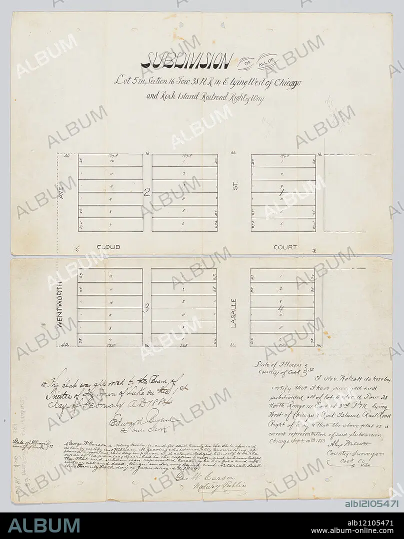
Title: Map of Englewood
Caption: Map of Englewood, Chicago, Illinois, 1883. View of Wentworth Avenue and LaSalle Street immediately north and south of Cloud Court. Handwritten record of approval by Board of Trustees of Town of Lake by Edward Bybel, town clerk, February 1, 1884; handwritten certification of accuracy by Alex Wolcott, county surveyor, September 10, 1883; handwritten certification of William M. Zearing as owner of land by Geo. W. Carson, notary public, January 26, 1884.
Credit: Album / Chicago History Museum / TopFoto
Releases: ? Model Release: No - ? Property Release: No
Rights questions?
Rights questions?
Image size: 4502 × 5706 px | 73.5 MB
Print size: 38.1 × 48.3 cm | 1772.4 × 2246.5 in (300 dpi)
Keywords: 1083. DNG • COMMUNITIES • COMMUNITY MAPS • ENGLEWOOD • MAPS • NEIGHBORHOODS
