alb1962068
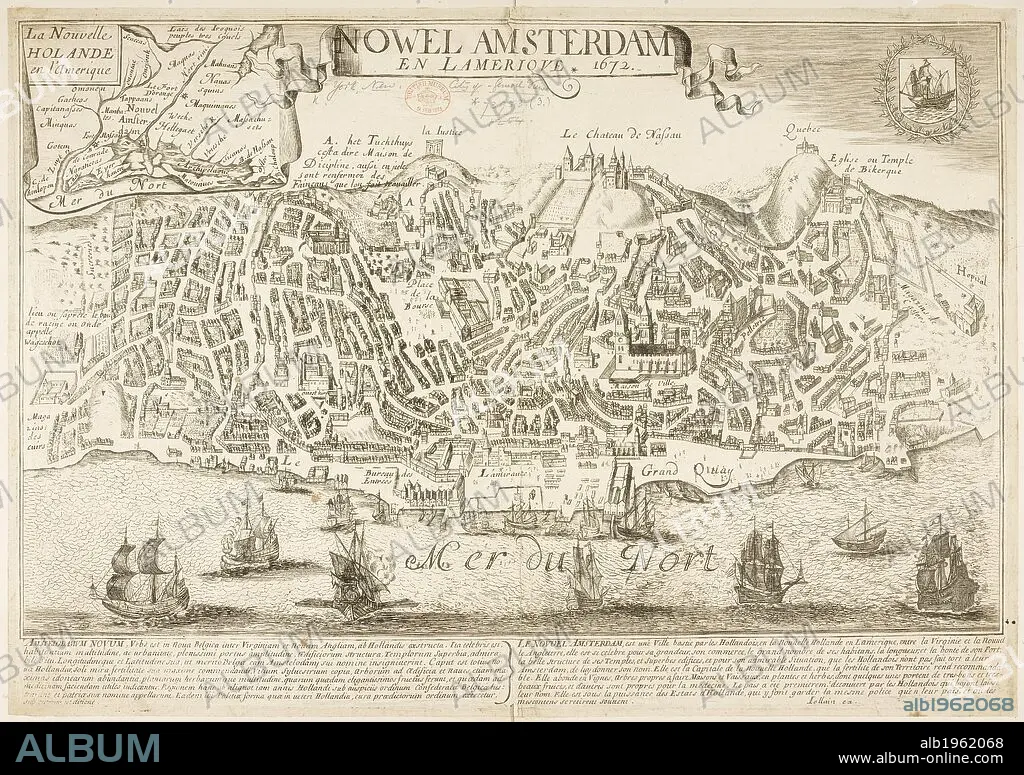
Map of New Amsterdam (New York) in 1672 and then in 1729, showing 88 years of growth. . Nowel Amsterdam 1729. New York, USA. Actual Map and Comparative Plans showing 88 years growth of the City of New York, by D. Longworth. (Plan of New York in 1729, surveyed by I. Lyne). Publisher/year :New York, 1817. Source: Maps.73953 (3).
| Share |
|---|
 Pinterest Pinterest |
 Twitter Twitter |
 Facebook Facebook |
 Copy link Copy link |
 Email Email |
|
Add to another lightbox |
|
Add to another lightbox |


Buy this image.
Select the use:

Caption:
Map of New Amsterdam (New York) in 1672 and then in 1729, showing 88 years of growth. . Nowel Amsterdam 1729. New York, USA. Actual Map and Comparative Plans showing 88 years growth of the City of New York, by D. Longworth. (Plan of New York in 1729, surveyed by I. Lyne). Publisher/year :New York, 1817. Source: Maps.73953 (3).
Credit:
Album / British Library
Releases:
Image size:
7144 x 5038 px | 103.0 MB
Print size:
60.5 x 42.7 cm | 23.8 x 16.8 in (300 dpi)
Keywords:
18TH CENTURY • 18TH CENTURY, THE • 18TH CENTURY. • 18TH • AMERICA NORTH • CARTE • CARTOGRAPHIC • CARTOGRAPHY • CITIES • CITY • CIUDAD • DATE BY CENTURY OF WORK OR SCENE • EEUU • MANHATTAN, NEW YORK • MAP MAKING • MAP • MAPS • NEW AMSTERDAM • NEW YORK CITY • NEW YORK • NEW YORK, USA • NORTH AMERICA • NORTH AMERICAN • PLAN (CARTOGRAPHY) • STYLE AND PERIOD • TOWN • TOWNS • U S A • U. S. A • U. S. A. • UNITED STATES AMERICA • UNITED STATES OF AMERICA • UNITED STATES • US STATES • USA • USA. UNITED STATES • XVIII CENTURY
