alb2258025
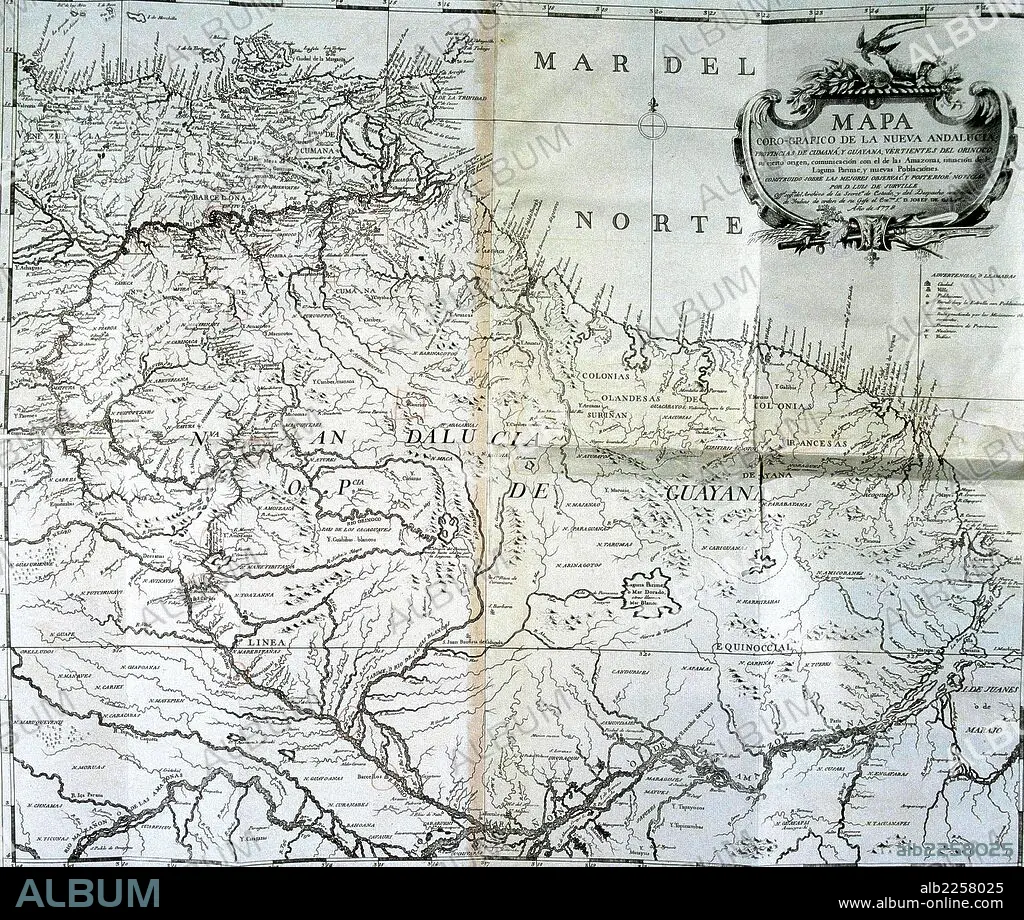
CARTOGRAFIA. MAPA DE LA NUEVA ANDALUCIA. LUIS DE SURVILLE , AÑO 1778. BIBLIOTECA NACIONAL.MADRID.
| Share |
|---|
 Pinterest Pinterest |
 Twitter Twitter |
 Facebook Facebook |
 Copy link Copy link |
 Email Email |
|
Add to another lightbox |
|
Add to another lightbox |


Buy this image.
Select the use:

Caption:
Automatic translation: MAPPING. MAP OF NEW ANDALUCIA. LUIS DE SURVILLE, YEAR 1778. NATIONAL LIBRARY. MADRID
CARTOGRAFIA. MAPA DE LA NUEVA ANDALUCIA. LUIS DE SURVILLE , AÑO 1778. BIBLIOTECA NACIONAL.MADRID
Credit:
Album / sfgp
Releases:
Image size:
3520 x 2979 px | 30.0 MB
Print size:
29.8 x 25.2 cm | 11.7 x 9.9 in (300 dpi)
Keywords:
18TH CENTURY • 18TH CENTURY, THE • 18TH CENTURY. • 18TH • MAP • MAPS • PLAN (CARTOGRAPHY) • XVIII CENTURY
