alb5534518
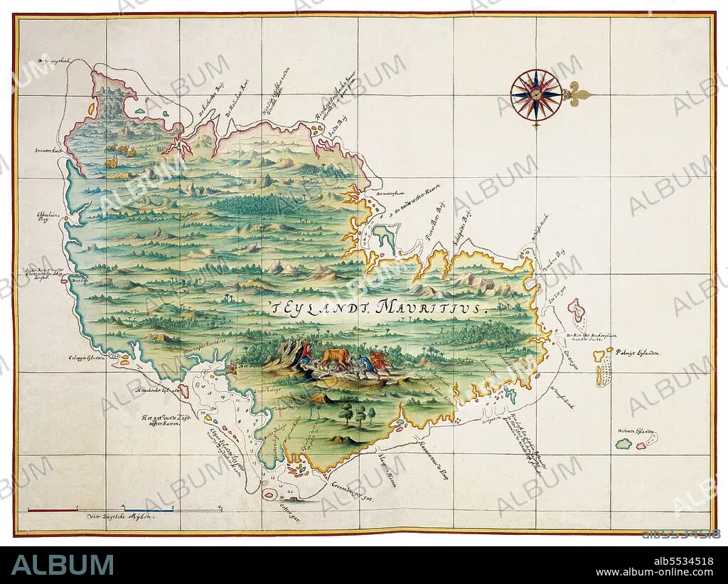
Mauritius: The Island of Mauritius, mid 17th century. Atlas Blaeu, Laurens Van der Hem, c. 1665
| Share |
|---|
 Pinterest Pinterest |
 Twitter Twitter |
 Facebook Facebook |
 Copy link Copy link |
 Email Email |
|
Add to another lightbox |
|
Add to another lightbox |


Title:
Mauritius: The Island of Mauritius, mid 17th century. Atlas Blaeu, Laurens Van der Hem, c. 1665
Caption:
The Atlas Maior is the final version of Joan Blaeu's atlas, published in Amsterdam between 1662 and 1672, in Latin (11 volumes), French (12 volumes), Dutch (9 volumes), German (10 volumes) and Spanish (10 volumes), containing 594 maps and around 3000 pages of text. It was the largest and most expensive book published in the seventeenth century. Earlier, much smaller versions, titled Theatrum Orbis Terrarum, sive, Atlas Novus, were published from 1634 onwards.
Credit:
Album / Pictures From History/Universal Images Group
Releases:
Model: No - Property: No
Rights questions?
Rights questions?
Image size:
4800 x 3600 px | 49.4 MB
Print size:
40.6 x 30.5 cm | 16.0 x 12.0 in (300 dpi)
Keywords:
AFRICA • AFRICAN • ASIA IMAGE • ASIA PICTURES • ASIA • ASIAN IMAGES • ASIAN PICTURES • ASIAN • CARDS • CARTOGRAPHY • CHART • CHARTS • DUTCH • HISTORIA UNIVERSAL • HISTORICAL IMAGES • HISTORICAL PICTURES • HISTORICAL • HISTORY IMAGES • HISTORY PICTURES • HISTORY • HOLLAND • INDIAN OCEAN • MAP MAKING • MAP • MAPS • MAURICIO • MAURITIUS • NETHERLANDISH • NETHERLANDS • PLAN (CARTOGRAPHY)
