alb3810008
Mercator's Atlas, 1633
| Share |
|---|
 Pinterest Pinterest |
 Twitter Twitter |
 Facebook Facebook |
 Copy link Copy link |
 Email Email |
|
Add to another lightbox |
|
Add to another lightbox |


Buy this image.
Select the use:

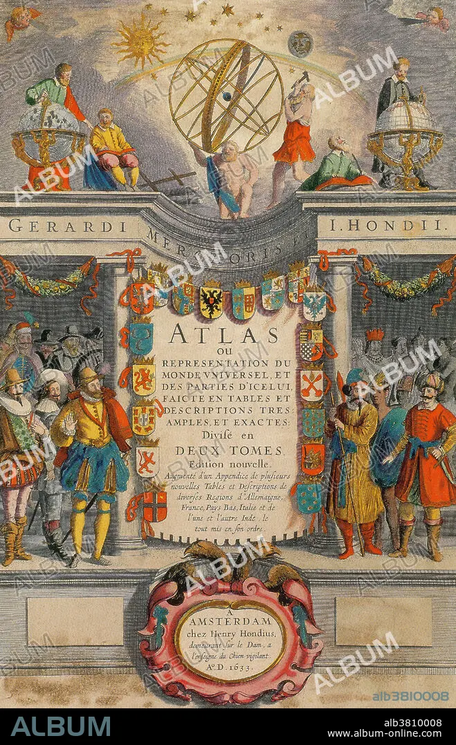
Title: Mercator's Atlas, 1633
Caption: This French-language work is a reprint of Mercator's Atlas, dating from 1633. The celebrated world atlas of Gerardus Mercator was first issued in 1595. The atlas contained a treatise on the creation of the world and 107 maps with geographical descriptions, of which 102 were compiled by Mercator himself. In 1602 the heirs of Mercator brought out a second edition of the atlas. In 1604 they sold all the copper plates from which the atlas was printed, to the Amsterdam publisher Jodocus Hondius the Elder, together with the rights to issue the atlas. Hondius continued to publish Mercator's work, constantly adding new maps and information. After Hondius' death in 1612, the atlas was continued by his sons. In 1638 publication was transferred to Jan Janssonius,
Credit: Album / Science Source / NEW YORK PUBLIC LIBRARY
Releases: ? Model Release: No - ? Property Release: No
Rights questions?
Rights questions?
Image size: 2655 × 4124 px | 31.3 MB
Print size: 22.5 × 34.9 cm | 1045.3 × 1623.6 in (300 dpi)
Keywords: 1630S • 1633 • 17TH CENTURY • 17TH CENTURY. • 17TH • 17TH-CENTURY • ARMS • ART • ARTWORK • ATLAS • BOOK • CALLIGRAPHY • CARTOGRAPHY • CENTURY • COAT • COLOR • DRAWING • EDITION • ELDER • EXPLORERS • FRENCH • FRONTISPIECE • GERARDUS • GLOBE • HEAVENS • HISTORIC • HISTORICAL • HISTORY • HONDIUS • ILLUMINATED • ILLUMINATION • ILLUSTRATION • ILLUSTRATIONS • ILUSTRATION • JODOCUS • MALES • MAN MEN • MANUSCRIPT • MAP MAKING • MAPS • MEN • MERCATOR • OF • OVERCOAT • PAGE • PAINTING • SHELTER • SHIELDS • SPHÈRE • STARS • THE • TITLE • WORLD • XVII CENTURY
